Area Overview for EN5 5PR
Photos of EN5 5PR

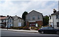
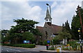


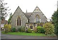
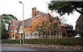
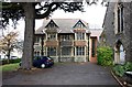
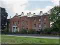
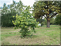
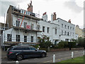
100 photos from this area
Area Information
Key information about the EN5 5PR including its size, population, and administrative classification.
- Area Type
- Postcode
- Area Size
- 9.2 hectares
- Population
- 1600
- Population Density
- 1048 people/km²
House Prices in EN5 5PR
21
Properties
£1,794,510
Average Sold Price
£506,000
Lowest Price
£4,665,000
Highest Price
Showing 21 properties
| Address | Type | Beds | Baths | Last Sale Price | Last Sale Date | |
|---|---|---|---|---|---|---|
| Hadley Cote, Hadley Green Road, Barnet, EN5 5PR | Terraced | 9 | 7 | £1,695,000 | Jan 2022 | |
| Hollybush, Hadley Green Road, Barnet, EN5 5PR | Semi-detached | - | - | £4,500,000 | Oct 2020 | |
| The Old Cottage, Hadley Green Road, Barnet, EN5 5PR | Terraced | 3 | 2 | £990,000 | Mar 2020 | |
| Northlands, Hadley Green Road, Barnet, EN5 5PR | house | 5 | 2 | £1,665,000 | May 2016 | |
| The Elms, Hadley Green Road, Barnet, EN5 5PR | Detached | 3 | 1 | £1,999,999 | Jan 2015 | |
| Grandon, Hadley Green Road, Barnet, EN5 5PR | Semi-detached | 6 | 4 | £4,665,000 | Apr 2014 | |
| Livingstone Cottage, Hadley Green Road, Barnet, EN5 5PR | house | - | - | £882,142 | Apr 2014 | |
| The Mercers, Hadley Green Road, Barnet, EN5 5PR | Detached | - | - | £1,735,000 | Mar 2007 | |
| Monken Cottage, Hadley Green Road, Barnet, EN5 5PR | Terraced | 4 | 2 | £935,000 | Aug 2005 | |
| The Grange, Hadley Green Road, Barnet, EN5 5PR | Terraced | - | - | £1,150,000 | Aug 2002 |
Page 1 of 3
Energy Efficiency in EN5 5PR
Amenities
Schools
| Rank | School | Type | Entry gender | Ages |
|---|
Explore more schools in this area
Go to Schools tabDemographics
Household Size
Family (3-5 people)
most common
Accommodation Type
Houses
most common
Tenure
79
majority
Ethnic Group
White
most common
Religion
N/A
most common
Household Composition
N/A
most common
Age
47
median
Adults (30-64 years)
most common
Household Deprivation
N/A
with no deprivation
NS-SEC
56
in Lower managerial occupations
Explore more demographic insights in this area
Go to Demographics tabPlanning
Planning Constraints
- Flood RiskPremium
- Ramsar Wetland SitesPremium
- Area of Outstanding Natural BeautyPremium
- Protected Nature ReservePremium
- Protected WoodlandPremium