Area Overview for EN5 5ND
Photos of EN5 5ND
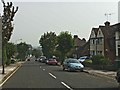
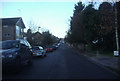
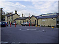


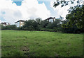

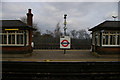
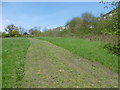
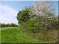
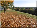

70 photos from this area
Area Information
Key information about the EN5 5ND including its size, population, and administrative classification.
- Area Type
- Postcode
- Area Size
- 1195 m²
- Population
- 1520
- Population Density
- 1412 people/km²
House Prices in EN5 5ND
12
Properties
£303,900
Average Sold Price
£94,500
Lowest Price
£455,000
Highest Price
Showing 12 properties
| Address | Type | Beds | Baths | Last Sale Price | Last Sale Date | |
|---|---|---|---|---|---|---|
| 89, Shelley Court, Woodville Road, New Barnet, Barnet, EN5 5ND | Flat | - | - | £455,000 | Mar 2021 | |
| 97, Shelley Court, Woodville Road, New Barnet, Barnet, EN5 5ND | Flat | - | - | £375,000 | Mar 2015 | |
| 95, Shelley Court, Woodville Road, New Barnet, Barnet, EN5 5ND | Flat | 2 | 2 | £410,000 | Jan 2015 | |
| 99, Shelley Court, Woodville Road, New Barnet, Barnet, EN5 5ND | Flat | - | - | £185,000 | Aug 2001 | |
| 93, Shelley Court, Woodville Road, New Barnet, Barnet, EN5 5ND | Flat | - | - | £94,500 | Jul 1997 | |
| 99 Woodville Road, New Barnet, Barnet, EN5 5ND | Flat | - | - | - | - | |
| 97 Woodville Road, New Barnet, Barnet, EN5 5ND | Flat | - | - | - | - | |
| 91 Woodville Road, New Barnet, Barnet, EN5 5ND | Flat | - | - | - | - | |
| 89 Woodville Road, New Barnet, Barnet, EN5 5ND | Flat | 2 | - | - | - | |
| 93 Woodville Road, New Barnet, Barnet, EN5 5ND | Flat | - | - | - | - |
Page 1 of 2
Energy Efficiency in EN5 5ND
Amenities
Schools
| Rank | School | Type | Entry gender | Ages |
|---|
Explore more schools in this area
Go to Schools tabDemographics
Household Size
Family (3-5 people)
most common
Accommodation Type
Houses
most common
Tenure
81
majority
Ethnic Group
White
most common
Religion
N/A
most common
Household Composition
N/A
most common
Age
47
median
Adults (30-64 years)
most common
Household Deprivation
N/A
with no deprivation
NS-SEC
53
in Lower managerial occupations
Explore more demographic insights in this area
Go to Demographics tabPlanning
Planning Constraints
- Flood RiskPremium
- Ramsar Wetland SitesPremium
- Area of Outstanding Natural BeautyPremium
- Protected Nature ReservePremium
- Protected WoodlandPremium