Area Overview for EN5 4LW
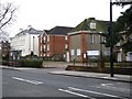
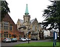
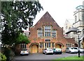
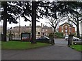
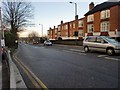
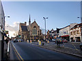
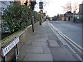
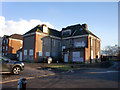
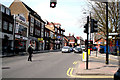
Photos of EN5 4LW


Area Information
EN5 4LW is a compact residential postcode in England, home to around 1,600 people spread across a small cluster of homes. With a population density of 1,048 people per square kilometre, it strikes a balance between intimacy and accessibility. The area is characterised by its mature demographic, with a median age of 47 and a strong presence of adults aged 30–64. This suggests a community rooted in stability, with many residents likely to be homeowners. Daily life here is shaped by proximity to key services, including retail hubs like Waitrose Barnet and Iceland Barnet, and easy access to transport links such as High Barnet Station. The area’s low crime risk and absence of environmental constraints make it appealing for families seeking a quiet yet connected lifestyle. While it lacks the sprawling infrastructure of larger towns, its small size fosters a sense of cohesion, with local amenities and schools within practical reach. For buyers, EN5 4LW offers a blend of practicality and tranquillity, ideal for those prioritising safety, convenience, and a settled community.
- Area Type
- Postcode
- Area Size
- Not available
- Population
- 1600
- Population Density
- 1048 people/km²
EN5 4LW is a predominantly owner-occupied area, with 79% of homes owned by residents rather than rented. The accommodation type is largely houses, which implies a focus on family-sized properties with more space than typical flats. This makes the area attractive to buyers seeking traditional housing stock, though the small postcode size means the market is limited in scale. The high home ownership rate suggests a stable, long-term resident base, which can influence property values and demand. For buyers, the proximity to schools, transport, and amenities adds to the area’s appeal, though the limited number of properties may create competition. The absence of rental properties or newer developments means the market is unlikely to cater to short-term or transient buyers. Those considering EN5 4LW should focus on the quality of local infrastructure and the area’s quiet, established character.
House Prices in EN5 4LW
No properties found in this postcode.
Energy Efficiency in EN5 4LW
EN5 4LW offers a range of amenities within practical reach, enhancing daily life. Retail options include major stores like Waitrose Barnet, Iceland Barnet, and Tesco High, providing access to groceries, household goods, and dining. The area’s transport links to High Barnet Station and other nearby stations make it easy to access larger shopping centres or leisure facilities further afield. While the data does not specify parks or recreational spaces, the absence of environmental constraints suggests open areas may be available nearby. The mix of retail and transport options supports a convenient, self-contained lifestyle, reducing the need for long commutes. For residents, the balance of local shops and connectivity to broader networks ensures both practicality and flexibility in daily routines.
Amenities
Schools
Residents of EN5 4LW have access to two notable educational institutions. Monken Hadley CofE Primary School, a state-funded primary school, holds an outstanding Ofsted rating, indicating high-quality teaching and facilities. This is a significant draw for families prioritising strong early education. Nearby, Mount House School offers independent education, catering to those seeking private schooling options. The mix of state and independent schools provides flexibility for parents, whether they prefer public or private education. The presence of a top-rated primary school enhances the area’s appeal, particularly for families with young children. However, no secondary schools are listed in the data, so buyers may need to consider proximity to larger educational hubs for older children.
| Rank | School | Type | Entry gender | Ages |
|---|
Explore more schools in this area
Go to Schools tabDemographics
The population of EN5 4LW is predominantly adults aged 30–64, reflecting a mature, established community. With a median age of 47, the area is less skewed towards younger or older demographics, suggesting a balance between working-age residents and those nearing retirement. Home ownership is high at 79%, indicating a strong presence of long-term residents and a stable housing market. The accommodation type is primarily houses, which aligns with the area’s focus on family-oriented living. The predominant ethnic group is White, though no specific data on diversity or deprivation is provided. This demographic profile suggests a community that values stability and continuity, with fewer transient populations. The absence of detailed diversity statistics means the area’s social fabric remains somewhat opaque, but the high home ownership rate and age distribution point to a cohesive, low-turnover environment.
Household Size
Accommodation Type
Tenure
Ethnic Group
Religion
Household Composition
Age
Household Deprivation
NS-SEC
Explore more demographic insights in this area
Go to Demographics tabPlanning
Planning Constraints
- Flood RiskPremium
- Ramsar Wetland SitesPremium
- Area of Outstanding Natural BeautyPremium
- Protected Nature ReservePremium
- Protected WoodlandPremium