Area Overview for EN5 4JG
Photos of EN5 4JG
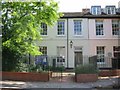
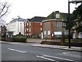
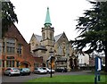
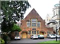
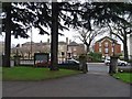
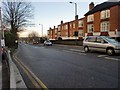
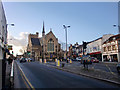
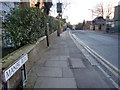
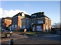
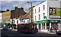
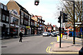
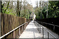
100 photos from this area
Area Information
Key information about the EN5 4JG including its size, population, and administrative classification.
- Area Type
- Postcode
- Area Size
- 6388 m²
- Population
- Not available
- Population Density
- Not available
House Prices in EN5 4JG
32
Properties
£488,122
Average Sold Price
£59,590
Lowest Price
£862,500
Highest Price
Showing 32 properties
| Address | Type | Beds | Baths | Last Sale Price | Last Sale Date | |
|---|---|---|---|---|---|---|
| 33 The Drive, Barnet, EN5 4JG | house | - | - | £862,500 | Mar 2025 | |
| 3 The Drive, Barnet, EN5 4JG | Terraced | 3 | 2 | £766,000 | Mar 2025 | |
| 57 The Drive, Barnet, EN5 4JG | Semi-detached | 3 | 1 | £735,000 | Feb 2025 | |
| 23 The Drive, Barnet, EN5 4JG | Terraced | 5 | 2 | £850,000 | Aug 2024 | |
| 5 The Drive, Barnet, EN5 4JG | house | - | - | £815,000 | Nov 2021 | |
| 27 The Drive, Barnet, EN5 4JG | house | - | - | £647,500 | Mar 2021 | |
| 59 The Drive, Barnet, EN5 4JG | Semi-detached | 4 | 2 | £857,333 | Jan 2021 | |
| 53 The Drive, Barnet, EN5 4JG | house | - | - | £845,000 | Aug 2018 | |
| 21 The Drive, Barnet, EN5 4JG | Terraced | - | - | £725,000 | May 2017 | |
| 13 The Drive, Barnet, EN5 4JG | Terraced | 2 | 1 | £595,000 | Sep 2016 |
Page 1 of 4
Energy Efficiency in EN5 4JG
Amenities
Schools
| Rank | School | Type | Entry gender | Ages |
|---|
Explore more schools in this area
Go to Schools tabDemographics
Household Size
Family (3-5 people)
most common
Accommodation Type
Houses
most common
Tenure
69
majority
Ethnic Group
White
most common
Religion
N/A
most common
Household Composition
N/A
most common
Age
47
median
Adults (30-64 years)
most common
Household Deprivation
N/A
with no deprivation
NS-SEC
53
in Lower managerial occupations
Explore more demographic insights in this area
Go to Demographics tabPlanning
Planning Constraints
- Flood RiskPremium
- Ramsar Wetland SitesPremium
- Area of Outstanding Natural BeautyPremium
- Protected Nature ReservePremium
- Protected WoodlandPremium