Area Overview for EN5 4HP
Photos of EN5 4HP
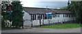
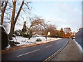
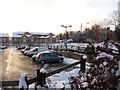
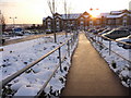


69 photos from this area
Area Information
Key information about the EN5 4HP including its size, population, and administrative classification.
- Area Type
- Postcode
- Area Size
- 6345 m²
- Population
- Not available
- Population Density
- Not available
House Prices in EN5 4HP
28
Properties
£427,435
Average Sold Price
£192,500
Lowest Price
£795,500
Highest Price
Showing 28 properties
| Address | Type | Beds | Baths | Last Sale Price | Last Sale Date | |
|---|---|---|---|---|---|---|
| 57 Sebright Road, Barnet, EN5 4HP | Detached | 3 | 2 | £795,500 | Jul 2025 | |
| 69A Sebright Road, Barnet, EN5 4HP | Terraced | 2 | 1 | £600,000 | Nov 2023 | |
| 53 Sebright Road, Barnet, EN5 4HP | Terraced | 3 | 2 | £625,000 | Jul 2023 | |
| 77 Sebright Road, Barnet, EN5 4HP | Maisonette | 2 | 1 | £335,000 | Mar 2023 | |
| 91 Sebright Road, Barnet, EN5 4HP | Terraced | 2 | 1 | £550,000 | Dec 2022 | |
| 51 Sebright Road, Barnet, EN5 4HP | Terraced | 3 | 1 | £695,000 | Jan 2021 | |
| 89 Sebright Road, Barnet, EN5 4HP | Terraced | 3 | 1 | £435,000 | Jul 2020 | |
| 101 Sebright Road, Barnet, EN5 4HP | Terraced | 2 | 1 | £490,000 | Dec 2017 | |
| 85 Sebright Road, Barnet, EN5 4HP | Terraced | 3 | - | £498,000 | Sep 2017 | |
| 65 Sebright Road, Barnet, EN5 4HP | Terraced | 3 | 2 | £625,000 | Jun 2016 |
Page 1 of 3
Energy Efficiency in EN5 4HP
Amenities
Schools
| Rank | School | Type | Entry gender | Ages |
|---|
Explore more schools in this area
Go to Schools tabDemographics
Household Size
Family (3-5 people)
most common
Accommodation Type
Houses
most common
Tenure
85
majority
Ethnic Group
White
most common
Religion
N/A
most common
Household Composition
N/A
most common
Age
47
median
Adults (30-64 years)
most common
Household Deprivation
N/A
with no deprivation
NS-SEC
54
in Lower managerial occupations
Explore more demographic insights in this area
Go to Demographics tabPlanning
Planning Constraints
- Flood RiskPremium
- Ramsar Wetland SitesPremium
- Area of Outstanding Natural BeautyPremium
- Protected Nature ReservePremium
- Protected WoodlandPremium