Area Overview for EN5 3EP
Photos of EN5 3EP
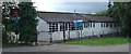
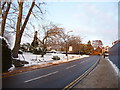
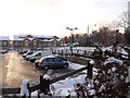
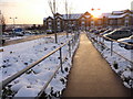


69 photos from this area
Area Information
Key information about the EN5 3EP including its size, population, and administrative classification.
- Area Type
- Postcode
- Area Size
- 8783 m²
- Population
- 1984
- Population Density
- 597 people/km²
House Prices in EN5 3EP
8
Properties
£1,006,833
Average Sold Price
£650,000
Lowest Price
£1,405,000
Highest Price
Showing 8 properties
| Address | Type | Beds | Baths | Last Sale Price | Last Sale Date | |
|---|---|---|---|---|---|---|
| Site Of 6, Barnet Road, Barnet, EN5 3EP | Detached | 4 | 6 | £750,000 | Mar 2021 | |
| Lightoak Lodge, 8 Barnet Road, Barnet, EN5 3EP | Detached | 5 | 4 | £886,000 | May 2020 | |
| Skinview Villa, 12 Barnet Road, Barnet, EN5 3EP | Detached | 6 | 4 | £1,405,000 | Dec 2018 | |
| The Jays, 16 Barnet Road, Barnet, EN5 3EP | Detached | 4 | 2 | £1,050,000 | Sep 2018 | |
| Moorings House, 10 Barnet Road, Barnet, EN5 3EP | Detached | 5 | 4 | £1,300,000 | Nov 2010 | |
| Pine Lodge, 14 Barnet Road, Barnet, EN5 3EP | house | - | - | £650,000 | Dec 2005 | |
| Moorings, Barnet Road, Barnet, EN5 3EP | Detached | - | - | - | - | |
| The Arkley Public House, 2 Barnet Road, Barnet, EN5 3EP | Leisure | - | - | - | - |
Energy Efficiency in EN5 3EP
Amenities
Schools
| Rank | School | Type | Entry gender | Ages |
|---|
Explore more schools in this area
Go to Schools tabDemographics
Household Size
Family (3-5 people)
most common
Accommodation Type
Houses
most common
Tenure
87
majority
Ethnic Group
White
most common
Religion
N/A
most common
Household Composition
N/A
most common
Age
47
median
Adults (30-64 years)
most common
Household Deprivation
N/A
with no deprivation
NS-SEC
52
in Lower managerial occupations
Explore more demographic insights in this area
Go to Demographics tabPlanning
Planning Constraints
- Flood RiskPremium
- Ramsar Wetland SitesPremium
- Area of Outstanding Natural BeautyPremium
- Protected Nature ReservePremium
- Protected WoodlandPremium