Area Overview for EN5 3DJ
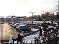
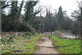
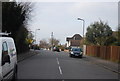
Photos of EN5 3DJ


Area Information
Living in EN5 3DJ offers a compact, residential experience shaped by its small area size of 6,985 m² and a population of 1,811. This postcode area is a tightly woven cluster of homes, with high population density of 259,266 people per km², suggesting a community focused on proximity to essential services. The area’s character is defined by its mix of local amenities and transport links, making it practical for daily life. Residents benefit from nearby retail outlets like Co-op Mays and Waitrose Barnet, while rail and metro stations such as High Barnet and Totteridge & Whetstone provide easy access to London’s broader network. The area’s appeal lies in its balance of residential tranquility and connectivity, though its density may mean a more closely knit, community-oriented environment. For those prioritising convenience over space, EN5 3DJ offers a self-contained lifestyle with minimal need to travel far for essentials.
- Area Type
- Postcode
- Area Size
- 6985 m²
- Population
- Not available
- Population Density
- Not available
EN5 3DJ’s property market is characterised by a 57% home ownership rate, suggesting a significant portion of the housing stock is owner-occupied. The area’s accommodation type is primarily houses, which contrasts with higher-density areas dominated by flats. This indicates a market skewed towards family homes and larger properties, appealing to buyers seeking space and privacy. However, the small area size of 6,985 m² and high population density imply limited scope for expansion or new developments. For buyers, this means competition for existing homes and a focus on maintaining property values within a tight geographical cluster. The predominance of houses may also mean a slower turnover rate compared to rental-heavy areas, with potential for long-term stability in the local market.
House Prices in EN5 3DJ
Showing 1 properties
| Address | Type | Beds | Baths | Last Sale Price | Last Sale Date | |
|---|---|---|---|---|---|---|
| Pharmacy, Barnet General Hospital, Wellhouse Lane, Barnet, EN5 3DJ | shop | - | - | - | - |
Energy Efficiency in EN5 3DJ
Life in EN5 3DJ is shaped by its proximity to essential amenities, including retail hubs like Co-op Mays, Waitrose Barnet, and Iceland Barnet, which cater to everyday shopping needs. The area’s transport network connects residents to broader leisure and employment opportunities, with stations such as High Barnet and Totteridge & Whetstone facilitating access to London’s cultural and professional centres. While the data does not specify parks or recreational facilities, the absence of protected natural areas or AONB coverage suggests a focus on urban living. The compact nature of the area means residents can reach most services on foot or by short journey, fostering a convenience-driven lifestyle. However, the lack of detailed information on dining or leisure venues leaves some aspects of the local character unexplored.
Amenities
Schools
| Rank | School | Type | Entry gender | Ages |
|---|
Explore more schools in this area
Go to Schools tabDemographics
The community in EN5 3DJ is predominantly composed of adults aged 30–64, with a median age of 47. This suggests a population skewed towards middle-aged individuals, likely including families and professionals. Home ownership sits at 57%, indicating a mix of owner-occupied properties and rental units. The area’s accommodation is largely houses, reflecting a preference for single-family homes over flats or apartments. The predominant ethnic group is White, though no specific diversity metrics are provided. The high population density of 259,266 people per km² implies a compact, possibly urbanised living environment, though the exact implications for quality of life—such as access to green space or social cohesion—are not quantified in the data.
Household Size
Accommodation Type
Tenure
Ethnic Group
Religion
Household Composition
Age
Household Deprivation
NS-SEC
Explore more demographic insights in this area
Go to Demographics tabPlanning
Planning Constraints
- Flood RiskPremium
- Ramsar Wetland SitesPremium
- Area of Outstanding Natural BeautyPremium
- Protected Nature ReservePremium
- Protected WoodlandPremium