Area Overview for EN5 2RG
Photos of EN5 2RG
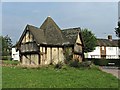


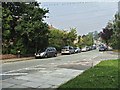
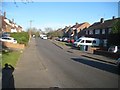
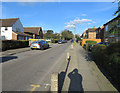


42 photos from this area
Area Information
Key information about the EN5 2RG including its size, population, and administrative classification.
- Area Type
- Postcode
- Area Size
- 6265 m²
- Population
- 1631
- Population Density
- 5963 people/km²
House Prices in EN5 2RG
28
Properties
£319,350
Average Sold Price
£78,500
Lowest Price
£590,000
Highest Price
Showing 28 properties
| Address | Type | Beds | Baths | Last Sale Price | Last Sale Date | |
|---|---|---|---|---|---|---|
| 16 Chesterfield Road, Barnet, EN5 2RG | Detached | 2 | 2 | £590,000 | Dec 2022 | |
| 18 Chesterfield Road, Barnet, EN5 2RG | Flat | - | - | £405,000 | Jun 2021 | |
| 18A Chesterfield Road, Barnet, EN5 2RG | Flat | 3 | - | £354,000 | Apr 2020 | |
| 17 Chesterfield Road, Barnet, EN5 2RG | Semi-detached | 3 | 2 | £359,950 | Jun 2012 | |
| 15 Chesterfield Road, Barnet, EN5 2RG | house | - | - | £330,000 | Nov 2006 | |
| 20A Chesterfield Road, Barnet, EN5 2RG | Flat | 1 | 1 | £118,000 | Feb 2001 | |
| 20 Chesterfield Road, Barnet, EN5 2RG | Flat | - | - | £78,500 | Sep 1998 | |
| 2 Chesterfield Road, Barnet, EN5 2RG | undefined | - | - | - | - | |
| Flat 9, Healey Court, 24 Chesterfield Road, Barnet, EN5 2RG | Flat | - | - | - | - | |
| 8 Chesterfield Road, Barnet, EN5 2RG | Flat | - | - | - | - |
Page 1 of 3
Energy Efficiency in EN5 2RG
Amenities
Schools
| Rank | School | Type | Entry gender | Ages |
|---|
Explore more schools in this area
Go to Schools tabDemographics
Household Size
Family (3-5 people)
most common
Accommodation Type
Houses
most common
Tenure
54
majority
Ethnic Group
White
most common
Religion
N/A
most common
Household Composition
N/A
most common
Age
47
median
Adults (30-64 years)
most common
Household Deprivation
N/A
with no deprivation
NS-SEC
31
in Lower managerial occupations
Explore more demographic insights in this area
Go to Demographics tabPlanning
Planning Constraints
- Flood RiskPremium
- Ramsar Wetland SitesPremium
- Area of Outstanding Natural BeautyPremium
- Protected Nature ReservePremium
- Protected WoodlandPremium