Area Overview for EN5 2QD
Photos of EN5 2QD
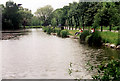

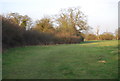
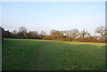
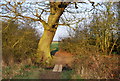

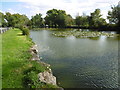
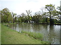
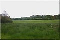
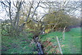


38 photos from this area
Area Information
Key information about the EN5 2QD including its size, population, and administrative classification.
- Area Type
- Postcode
- Area Size
- 6.7 hectares
- Population
- 1365
- Population Density
- 271 people/km²
House Prices in EN5 2QD
24
Properties
£300,125
Average Sold Price
£81,500
Lowest Price
£520,000
Highest Price
Showing 24 properties
| Address | Type | Beds | Baths | Last Sale Price | Last Sale Date | |
|---|---|---|---|---|---|---|
| 89 Ridgeview Close, Underhill, Barnet, EN5 2QD | Terraced | 3 | 1 | £520,000 | May 2025 | |
| 95 Ridgeview Close, Underhill, Barnet, EN5 2QD | Semi-detached | 2 | 1 | £460,000 | Jun 2021 | |
| 67 Ridgeview Close, Underhill, Barnet, EN5 2QD | Terraced | 2 | - | £400,000 | Apr 2017 | |
| 107 Ridgeview Close, Underhill, Barnet, EN5 2QD | Terraced | 2 | 1 | £410,000 | Aug 2016 | |
| 85 Ridgeview Close, Underhill, Barnet, EN5 2QD | house | 4 | - | £350,000 | Jul 2015 | |
| 69 Ridgeview Close, Underhill, Barnet, EN5 2QD | house | - | - | £315,000 | Oct 2014 | |
| 103 Ridgeview Close, Underhill, Barnet, EN5 2QD | Terraced | 3 | - | £250,000 | Sep 2009 | |
| 75 Ridgeview Close, Underhill, Barnet, EN5 2QD | Terraced | - | - | £265,000 | Aug 2009 | |
| 73 Ridgeview Close, Underhill, Barnet, EN5 2QD | Terraced | - | - | £237,000 | Jan 2007 | |
| 93 Ridgeview Close, Underhill, Barnet, EN5 2QD | Semi-detached | - | - | £171,000 | Sep 2004 |
Page 1 of 3
Energy Efficiency in EN5 2QD
Amenities
Schools
| Rank | School | Type | Entry gender | Ages |
|---|
Explore more schools in this area
Go to Schools tabDemographics
Household Size
Family (3-5 people)
most common
Accommodation Type
Houses
most common
Tenure
86
majority
Ethnic Group
White
most common
Religion
N/A
most common
Household Composition
N/A
most common
Age
47
median
Adults (30-64 years)
most common
Household Deprivation
N/A
with no deprivation
NS-SEC
50
in Lower managerial occupations
Explore more demographic insights in this area
Go to Demographics tabPlanning
Planning Constraints
- Flood RiskPremium
- Ramsar Wetland SitesPremium
- Area of Outstanding Natural BeautyPremium
- Protected Nature ReservePremium
- Protected WoodlandPremium