Area Overview for EN5 2ED
Photos of EN5 2ED
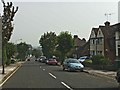
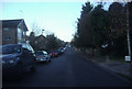
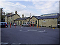


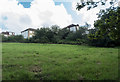


70 photos from this area
Area Information
Key information about the EN5 2ED including its size, population, and administrative classification.
- Area Type
- Postcode
- Area Size
- 2.7 hectares
- Population
- 1548
- Population Density
- 4588 people/km²
House Prices in EN5 2ED
29
Properties
£379,433
Average Sold Price
£100,000
Lowest Price
£703,000
Highest Price
Showing 29 properties
| Address | Type | Beds | Baths | Last Sale Price | Last Sale Date | |
|---|---|---|---|---|---|---|
| 48 Vale Drive, Barnet, EN5 2ED | Semi-detached | 3 | 1 | £650,000 | May 2024 | |
| 44 Vale Drive, Barnet, EN5 2ED | Semi-detached | 3 | 1 | £703,000 | Dec 2022 | |
| 18 Vale Drive, Barnet, EN5 2ED | Semi-detached | 4 | 3 | £690,000 | Sep 2020 | |
| 46 Vale Drive, Barnet, EN5 2ED | Semi-detached | 3 | - | £455,000 | Jan 2014 | |
| 30 Vale Drive, Barnet, EN5 2ED | house | 3 | - | £500,000 | Jun 2013 | |
| 4 Vale Drive, Barnet, EN5 2ED | house | - | - | £460,000 | Aug 2012 | |
| 28 Vale Drive, Barnet, EN5 2ED | Semi-detached | 3 | - | £343,000 | Nov 2006 | |
| 14 Vale Drive, Barnet, EN5 2ED | Semi-detached | 3 | 1 | £300,000 | Jul 2006 | |
| 24 Vale Drive, Barnet, EN5 2ED | Semi-detached | - | - | £262,000 | Feb 2006 | |
| 36 Vale Drive, Barnet, EN5 2ED | Terraced | 5 | 2 | £304,000 | Nov 2003 |
Page 1 of 3
Energy Efficiency in EN5 2ED
Amenities
Schools
| Rank | School | Type | Entry gender | Ages |
|---|
Explore more schools in this area
Go to Schools tabDemographics
Household Size
Family (3-5 people)
most common
Accommodation Type
Houses
most common
Tenure
75
majority
Ethnic Group
White
most common
Religion
N/A
most common
Household Composition
N/A
most common
Age
47
median
Adults (30-64 years)
most common
Household Deprivation
N/A
with no deprivation
NS-SEC
43
in Lower managerial occupations
Explore more demographic insights in this area
Go to Demographics tabPlanning
Planning Constraints
- Flood RiskPremium
- Ramsar Wetland SitesPremium
- Area of Outstanding Natural BeautyPremium
- Protected Nature ReservePremium
- Protected WoodlandPremium