Area Overview for EN5 1JN
Photos of EN5 1JN


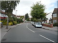
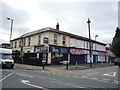
45 photos from this area
Area Information
Key information about the EN5 1JN including its size, population, and administrative classification.
- Area Type
- Postcode
- Area Size
- 1.5 hectares
- Population
- Not available
- Population Density
- Not available
House Prices in EN5 1JN
15
Properties
£805,500
Average Sold Price
£334,500
Lowest Price
£1,388,500
Highest Price
Showing 15 properties
| Address | Type | Beds | Baths | Last Sale Price | Last Sale Date | |
|---|---|---|---|---|---|---|
| 4 Willenhall Avenue, New Barnet, Barnet, EN5 1JN | Detached | 4 | 4 | £1,388,500 | Jan 2025 | |
| 6 Willenhall Avenue, New Barnet, Barnet, EN5 1JN | house | - | - | £1,250,000 | Jan 2022 | |
| Tilsworth, 12 Willenhall Avenue, New Barnet, Barnet, EN5 1JN | Detached | 4 | 2 | £986,000 | Oct 2015 | |
| Derwin, 11 Willenhall Avenue, New Barnet, Barnet, EN5 1JN | Bungalow | 2 | 2 | £875,000 | Jul 2015 | |
| 2 Willenhall Avenue, New Barnet, Barnet, EN5 1JN | Detached | 3 | - | £652,500 | Oct 2013 | |
| Wyncroft, 10 Willenhall Avenue, New Barnet, Barnet, EN5 1JN | Maisonette | 2 | 1 | £587,500 | Oct 2004 | |
| 8A Willenhall Avenue, New Barnet, Barnet, EN5 1JN | Detached | 5 | 5 | £370,000 | Oct 1996 | |
| 8 Willenhall Avenue, New Barnet, Barnet, EN5 1JN | Detached | 5 | 3 | £334,500 | Jul 1995 | |
| Oakville, 3 Willenhall Avenue, New Barnet, Barnet, EN5 1JN | Detached | 4 | 5 | - | - | |
| Shrublands, 1 Willenhall Avenue, New Barnet, Barnet, EN5 1JN | Detached | 3 | 3 | - | - |
Page 1 of 2
Energy Efficiency in EN5 1JN
Amenities
Schools
| Rank | School | Type | Entry gender | Ages |
|---|
Explore more schools in this area
Go to Schools tabDemographics
Household Size
Family (3-5 people)
most common
Accommodation Type
Houses
most common
Tenure
75
majority
Ethnic Group
White
most common
Religion
N/A
most common
Household Composition
N/A
most common
Age
47
median
Adults (30-64 years)
most common
Household Deprivation
N/A
with no deprivation
NS-SEC
46
in Lower managerial occupations
Explore more demographic insights in this area
Go to Demographics tabPlanning
Planning Constraints
- Flood RiskPremium
- Ramsar Wetland SitesPremium
- Area of Outstanding Natural BeautyPremium
- Protected Nature ReservePremium
- Protected WoodlandPremium