Area Overview for EN4 9QY
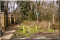
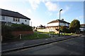
Photos of EN4 9QY


Area Information
EN4 9QY is a small, tightly knit residential area in England, home to 1,631 people. It is a compact cluster of properties, predominantly houses, reflecting a community that values stability and space. The area’s population is largely composed of adults aged 30–64, with a median age of 47, suggesting a mature demographic that may be settled in long-term careers or retirement. Daily life here is shaped by proximity to transport networks and local amenities. Residents benefit from multiple rail and metro stations within reach, including New Barnet, Oakleigh Park, and High Barnet, which connect to London’s broader transport system. The area’s low flood risk and absence of environmental constraints like protected woodlands or AONB designations make it practical for families and professionals. With a safety score of 86 out of 100, it is among the safer neighbourhoods in the region. The mix of retail options, from Tesco Barnet to Aldi Brookhill, ensures convenience for everyday needs. EN4 9QY offers a quiet, accessible lifestyle, blending suburban comfort with urban connectivity.
- Area Type
- Postcode
- Area Size
- Not available
- Population
- 1631
- Population Density
- 6839 people/km²
EN4 9QY is a housing market where 60% of properties are owner-occupied, with the remaining 40% likely rented out. The area is dominated by houses rather than flats, which is uncommon in more densely populated zones. This suggests a focus on family homes or larger properties, which may appeal to buyers seeking space and privacy. The small size of the area means that the housing stock is limited, and buyers should consider the immediate surroundings for more options. The high proportion of owner-occupied properties indicates a stable market, but the lack of data on rental demand or property prices means buyers must conduct further local research. The absence of planning constraints like protected woodlands or AONB designations also makes the area more flexible for development or renovation.
House Prices in EN4 9QY
No properties found in this postcode.
Energy Efficiency in EN4 9QY
Living in EN4 9QY offers a blend of convenience and accessibility. The area is served by major retail chains such as Tesco Barnet, Sainsburys New, and Aldi Brookhill, providing easy access to groceries and daily essentials. For transport, residents can use nearby rail stations like New Barnet and Hadley Wood, as well as metro stops at Cockfosters and High Barnet, which link to central London and beyond. While the data does not specify parks or leisure facilities, the absence of environmental constraints like Ramsar sites or protected woodlands suggests open spaces may be available nearby. The variety of transport options and retail choices contributes to a practical, low-stress lifestyle, ideal for those who value ease of movement and access to urban amenities without the congestion of city centres.
Amenities
Schools
| Rank | School | Type | Entry gender | Ages |
|---|
Explore more schools in this area
Go to Schools tabDemographics
The community in EN4 9QY is predominantly composed of adults aged 30–64, with a median age of 47. This suggests a population that is largely established in careers or in later life stages. Home ownership is strong, with 60% of residents owning their properties, indicating a stable housing market. The area is characterised by houses rather than flats, reflecting a preference for family-friendly or spacious living. The predominant ethnic group is White, though no specific data on diversity or deprivation is provided. The age profile and ownership figures suggest a community that is less transient, with residents likely to have long-term ties to the area. The absence of specific data on deprivation means that quality of life can be inferred from the safety and infrastructure metrics, which are largely positive.
Household Size
Accommodation Type
Tenure
Ethnic Group
Religion
Household Composition
Age
Household Deprivation
NS-SEC
Explore more demographic insights in this area
Go to Demographics tabPlanning
Planning Constraints
- Flood RiskPremium
- Ramsar Wetland SitesPremium
- Area of Outstanding Natural BeautyPremium
- Protected Nature ReservePremium
- Protected WoodlandPremium