Area Overview for EN4 9QF
Photos of EN4 9QF
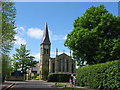
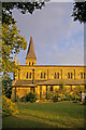
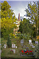


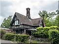
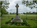
100 photos from this area
Area Information
Key information about the EN4 9QF including its size, population, and administrative classification.
- Area Type
- Postcode
- Area Size
- 2.1 hectares
- Population
- 1631
- Population Density
- 6839 people/km²
House Prices in EN4 9QF
47
Properties
£548,800
Average Sold Price
£115,000
Lowest Price
£975,000
Highest Price
Showing 47 properties
| Address | Type | Beds | Baths | Last Sale Price | Last Sale Date | |
|---|---|---|---|---|---|---|
| 54 Park Road, New Barnet, Barnet, EN4 9QF | house | - | - | £277,000 | Oct 2022 | |
| 86 Park Road, New Barnet, Barnet, EN4 9QF | house | - | - | £975,000 | Dec 2021 | |
| 34 Park Road, New Barnet, Barnet, EN4 9QF | house | - | - | £734,000 | Mar 2021 | |
| 64 Park Road, New Barnet, Barnet, EN4 9QF | house | - | - | £442,500 | Nov 2020 | |
| 44 Park Road, New Barnet, Barnet, EN4 9QF | house | 4 | 1 | £785,000 | Mar 2020 | |
| 88 Park Road, New Barnet, Barnet, EN4 9QF | hospital_care_home | - | - | £530,000 | Apr 2019 | |
| 52 Park Road, New Barnet, Barnet, EN4 9QF | house | - | - | £400,000 | Oct 2016 | |
| 42 Park Road, New Barnet, Barnet, EN4 9QF | Semi-detached | 4 | 1 | £780,000 | Mar 2016 | |
| 82 Park Road, New Barnet, Barnet, EN4 9QF | Detached | 4 | 1 | £815,000 | Feb 2015 | |
| 38 Park Road, New Barnet, Barnet, EN4 9QF | Semi-detached | 4 | 2 | £565,000 | Jan 2014 |
Page 1 of 5
Energy Efficiency in EN4 9QF
Amenities
Schools
| Rank | School | Type | Entry gender | Ages |
|---|
Explore more schools in this area
Go to Schools tabDemographics
Household Size
Family (3-5 people)
most common
Accommodation Type
Houses
most common
Tenure
60
majority
Ethnic Group
White
most common
Religion
N/A
most common
Household Composition
N/A
most common
Age
47
median
Adults (30-64 years)
most common
Household Deprivation
N/A
with no deprivation
NS-SEC
46
in Lower managerial occupations
Explore more demographic insights in this area
Go to Demographics tabPlanning
Planning Constraints
- Flood RiskPremium
- Ramsar Wetland SitesPremium
- Area of Outstanding Natural BeautyPremium
- Protected Nature ReservePremium
- Protected WoodlandPremium