Area Overview for EN4 9ET
Photos of EN4 9ET
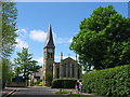
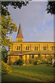
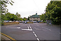
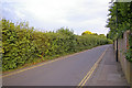
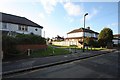
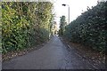


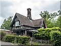

100 photos from this area
Area Information
Key information about the EN4 9ET including its size, population, and administrative classification.
- Area Type
- Postcode
- Area Size
- 1.8 hectares
- Population
- 1620
- Population Density
- 4382 people/km²
House Prices in EN4 9ET
35
Properties
£471,042
Average Sold Price
£124,500
Lowest Price
£1,150,000
Highest Price
Showing 35 properties
| Address | Type | Beds | Baths | Last Sale Price | Last Sale Date | |
|---|---|---|---|---|---|---|
| 71 Mount Pleasant, Barnet, EN4 9ET | Detached | 3 | 2 | £850,000 | Oct 2024 | |
| 73 Mount Pleasant, Barnet, EN4 9ET | Flat | 3 | 1 | £780,000 | May 2024 | |
| 97 Mount Pleasant, Barnet, EN4 9ET | Semi-detached | 3 | - | £754,000 | Apr 2024 | |
| 67 Mount Pleasant, Barnet, EN4 9ET | Detached | 5 | 3 | £1,150,000 | Mar 2021 | |
| 79 Mount Pleasant, Barnet, EN4 9ET | Semi-detached | 4 | 2 | £895,000 | Oct 2020 | |
| 105 Mount Pleasant, Barnet, EN4 9ET | house | 3 | - | £610,000 | Nov 2015 | |
| 61 Mount Pleasant, Barnet, EN4 9ET | Detached | 4 | 3 | £810,000 | Apr 2015 | |
| 121 Mount Pleasant, Barnet, EN4 9ET | Terraced | 3 | 1 | £150,000 | Mar 2015 | |
| 85 Mount Pleasant, Barnet, EN4 9ET | Semi-detached | 4 | 2 | £551,000 | Jan 2015 | |
| 119 Mount Pleasant, Barnet, EN4 9ET | Semi-detached | - | - | £482,390 | Aug 2012 |
Page 1 of 4
Energy Efficiency in EN4 9ET
Amenities
Schools
| Rank | School | Type | Entry gender | Ages |
|---|
Explore more schools in this area
Go to Schools tabDemographics
Household Size
Family (3-5 people)
most common
Accommodation Type
Houses
most common
Tenure
65
majority
Ethnic Group
White
most common
Religion
N/A
most common
Household Composition
N/A
most common
Age
47
median
Adults (30-64 years)
most common
Household Deprivation
N/A
with no deprivation
NS-SEC
39
in Lower managerial occupations
Explore more demographic insights in this area
Go to Demographics tabPlanning
Planning Constraints
- Flood RiskPremium
- Ramsar Wetland SitesPremium
- Area of Outstanding Natural BeautyPremium
- Protected Nature ReservePremium
- Protected WoodlandPremium