Area Overview for EN4 8RF
Photos of EN4 8RF
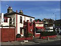
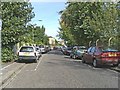
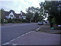
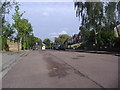

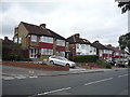
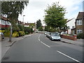
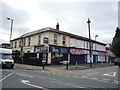
45 photos from this area
Area Information
Key information about the EN4 8RF including its size, population, and administrative classification.
- Area Type
- Postcode
- Area Size
- 1.0 hectares
- Population
- 2289
- Population Density
- 6874 people/km²
House Prices in EN4 8RF
48
Properties
£177,720
Average Sold Price
£100
Lowest Price
£455,000
Highest Price
Showing 48 properties
| Address | Type | Beds | Baths | Last Sale Price | Last Sale Date | |
|---|---|---|---|---|---|---|
| 111 East Barnet Road, Station Road To Brookhill Road, Barnet, EN4 8RF | Terraced | 3 | 1 | £455,000 | Oct 2020 | |
| 121A East Barnet Road, Station Road To Brookhill Road, Barnet, EN4 8RF | Flat | 2 | 2 | £100 | Nov 2018 | |
| 117 East Barnet Road, Station Road To Brookhill Road, Barnet, EN4 8RF | Semi-detached | - | - | £194,000 | Oct 2001 | |
| 103B East Barnet Road, Station Road To Brookhill Road, Barnet, EN4 8RF | Flat | 3 | 1 | £128,500 | Dec 2000 | |
| 109 East Barnet Road, Station Road To Brookhill Road, Barnet, EN4 8RF | Flat | 2 | 1 | £111,000 | Oct 1997 | |
| 125A East Barnet Road, Station Road To Brookhill Road, Barnet, EN4 8RF | Land | - | - | - | - | |
| First Floor Flat, 83 East Barnet Road, Station Road To Brookhill Road, Barnet, EN4 8RF | Flat | 3 | 1 | - | - | |
| Staff Quarters The Alexandra, 133 East Barnet Road, Station Road To Brookhill Road, Barnet, EN4 8RF | Flat | - | - | - | - | |
| 127A East Barnet Road, Station Road To Brookhill Road, Barnet, EN4 8RF | Flat | - | - | - | - | |
| 85A East Barnet Road, Station Road To Brookhill Road, Barnet, EN4 8RF | Flat | - | - | - | - |
Page 1 of 5
Energy Efficiency in EN4 8RF
Amenities
Schools
| Rank | School | Type | Entry gender | Ages |
|---|
Explore more schools in this area
Go to Schools tabDemographics
Household Size
Family (3-5 people)
most common
Accommodation Type
Flats
most common
Tenure
35
majority
Ethnic Group
White
most common
Religion
N/A
most common
Household Composition
N/A
most common
Age
47
median
Adults (30-64 years)
most common
Household Deprivation
N/A
with no deprivation
NS-SEC
34
in Lower managerial occupations
Explore more demographic insights in this area
Go to Demographics tabPlanning
Planning Constraints
- Flood RiskPremium
- Ramsar Wetland SitesPremium
- Area of Outstanding Natural BeautyPremium
- Protected Nature ReservePremium
- Protected WoodlandPremium