Area Overview for EN4 8NH
Photos of EN4 8NH
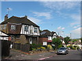
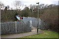
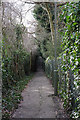
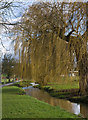
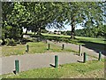
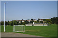


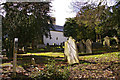

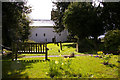
83 photos from this area
Area Information
Key information about the EN4 8NH including its size, population, and administrative classification.
- Area Type
- Postcode
- Area Size
- 7958 m²
- Population
- 1736
- Population Density
- 5242 people/km²
House Prices in EN4 8NH
26
Properties
£440,000
Average Sold Price
£127,000
Lowest Price
£700,000
Highest Price
Showing 26 properties
| Address | Type | Beds | Baths | Last Sale Price | Last Sale Date | |
|---|---|---|---|---|---|---|
| 13 Burlington Rise, East Barnet, Barnet, EN4 8NH | Terraced | 3 | 1 | £616,000 | Jun 2025 | |
| 47 Burlington Rise, East Barnet, Barnet, EN4 8NH | Terraced | 4 | 2 | £700,000 | Mar 2025 | |
| 49 Burlington Rise, East Barnet, Barnet, EN4 8NH | Terraced | 3 | 2 | £560,000 | Aug 2023 | |
| 37 Burlington Rise, East Barnet, Barnet, EN4 8NH | house | - | - | £540,000 | Nov 2020 | |
| 33 Burlington Rise, East Barnet, Barnet, EN4 8NH | Terraced | 3 | 1 | £510,000 | Mar 2018 | |
| 21 Burlington Rise, East Barnet, Barnet, EN4 8NH | Terraced | 3 | - | £525,000 | Oct 2017 | |
| 25 Burlington Rise, East Barnet, Barnet, EN4 8NH | Semi-detached | 3 | 1 | £550,000 | Mar 2016 | |
| 29 Burlington Rise, East Barnet, Barnet, EN4 8NH | house | - | - | £642,000 | Apr 2014 | |
| 3 Burlington Rise, East Barnet, Barnet, EN4 8NH | Terraced | 3 | 1 | £408,000 | Mar 2014 | |
| 15 Burlington Rise, East Barnet, Barnet, EN4 8NH | Terraced | 3 | - | £370,000 | Jul 2013 |
Page 1 of 3
Energy Efficiency in EN4 8NH
Amenities
Schools
| Rank | School | Type | Entry gender | Ages |
|---|
Explore more schools in this area
Go to Schools tabDemographics
Household Size
Family (3-5 people)
most common
Accommodation Type
Houses
most common
Tenure
81
majority
Ethnic Group
White
most common
Religion
N/A
most common
Household Composition
N/A
most common
Age
47
median
Adults (30-64 years)
most common
Household Deprivation
N/A
with no deprivation
NS-SEC
40
in Lower managerial occupations
Explore more demographic insights in this area
Go to Demographics tabPlanning
Planning Constraints
- Flood RiskPremium
- Ramsar Wetland SitesPremium
- Area of Outstanding Natural BeautyPremium
- Protected Nature ReservePremium
- Protected WoodlandPremium