Area Overview for EN4 8DN
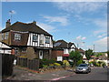
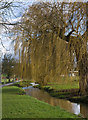
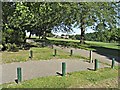
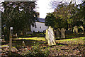
Photos of EN4 8DN


Area Information
Living in EN4 8DN offers a quiet, residential experience in a small cluster of homes with a population of 2031. The area is defined by its compact size and proximity to transport links, making it accessible for commuters while retaining a sense of local character. Residents here are predominantly adults aged 30–64, reflecting a mature community with strong home ownership—81% of properties are owner-occupied. The housing stock is largely composed of detached or semi-detached houses, which contributes to a stable, long-term demographic. Daily life is shaped by the area’s low crime risk, with a safety score of 82, and excellent digital connectivity, ensuring reliable broadband and mobile coverage. Nearby, residents can access multiple rail and metro stations, including New Barnet and Totteridge & Whetstone, while local retail options like Tesco Barnet and Aldi Brookhill provide convenience. EN4 8DN is ideal for those seeking a balanced blend of practicality, safety, and proximity to urban amenities without the density of a larger city.
- Area Type
- Postcode
- Area Size
- Not available
- Population
- 2031
- Population Density
- 4056 people/km²
The property market in EN4 8DN is dominated by owner-occupied homes, with 81% of properties in private hands. The accommodation type is predominantly houses, which suggests a focus on family-friendly or semi-detached living. This contrasts with areas where flats or apartments dominate, making EN4 8DN more suited to buyers prioritising space and long-term stability. Given the small size of the postcode area, the housing stock is limited, meaning buyers may need to consider nearby regions for more options. The high home ownership rate indicates a community with strong local ties, which can influence property values and demand. For those seeking a low-maintenance, established home in a safe environment, this area offers a straightforward, owner-occupied market with minimal rental activity.
House Prices in EN4 8DN
No properties found in this postcode.
Energy Efficiency in EN4 8DN
Residents of EN4 8DN have access to a range of local amenities, including retail options like Tesco Barnet, Aldi Brookhill, and Co-op East, which provide essential shopping and convenience. The area’s transport links also grant easy access to broader leisure opportunities, such as parks, dining, and cultural venues in nearby towns. The presence of multiple rail and metro stations, including New Southgate and Oakwood, ensures that residents can reach urban centres quickly for work, entertainment, or socialising. While the data does not specify local parks or recreational spaces, the proximity to transport hubs suggests a lifestyle that balances local convenience with broader urban access. This makes EN4 8DN appealing to those who value practicality without sacrificing the ability to engage with larger amenities.
Amenities
Schools
| Rank | School | Type | Entry gender | Ages |
|---|
Explore more schools in this area
Go to Schools tabDemographics
The community in EN4 8DN is predominantly composed of adults aged 30–64, with a median age of 47. This suggests a settled population, likely with established careers and families. Home ownership is high at 81%, indicating a strong preference for long-term residency over rental properties. The area is characterised by houses rather than flats, which aligns with the demographic profile of older, family-oriented residents. The predominant ethnic group is White, though no specific data on diversity or deprivation is provided. The age range and home ownership figures imply a stable, low-turnover community with a focus on continuity. This profile may appeal to buyers seeking a neighbourhood with a mature, reliable population and minimal transient activity.
Household Size
Accommodation Type
Tenure
Ethnic Group
Religion
Household Composition
Age
Household Deprivation
NS-SEC
Explore more demographic insights in this area
Go to Demographics tabPlanning
Planning Constraints
- Flood RiskPremium
- Ramsar Wetland SitesPremium
- Area of Outstanding Natural BeautyPremium
- Protected Nature ReservePremium
- Protected WoodlandPremium