Area Overview for EN4 0PS
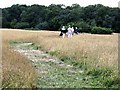
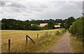
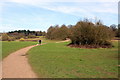
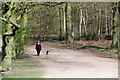
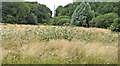
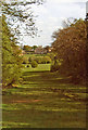
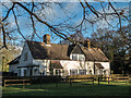
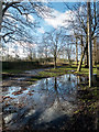
Photos of EN4 0PS


Area Information
Living in EN4 0PS means residing within a tightly defined residential landscape covering just 1.6 km². This specific postcode cluster holds a population of 1,887 people, creating a neighbourhood where daily interactions often occur through shared local amenities rather than vast distances. The area sits firmly within the greater London framework, serving as a quiet residential enclave that prioritises established housing over new development. You are entering a community where the pace of life remains steady, defined by existing infrastructure and long-standing neighbourhood patterns. The small footprint ensures that the local environment feels intimate, with every street contributing to a cohesive sense of place. Residents here do not contend with the sprawl typical of larger urban zones; instead, they navigate a space where the distinction between home and immediate surroundings is minimal. This concentration of population within such a limited area creates a distinct identity, separate from the wider housing market found in adjacent postcodes. Understanding this compact nature helps you appreciate why local resources feel so accessible to everyone living in EN4 0PS.
- Area Type
- Postcode
- Area Size
- 1.6 km²
- Population
- 1887
- Population Density
- 331 people/km²
The property market in EN4 0PS is overwhelmingly characterised by owner-occupation rather than the rental sector. With 86% of residents owning their homes, the housing stock reflects decisions made over years or decades rather than transient tenancies. This figure suggests that the area appeals to borrowers seeking stability and those looking to build equity rather than investors targeting short-term lets. The predominant accommodation type within EN4 0PS consists of houses, which defines the visual and spatial quality of the streets. Buyers looking for this postcode should expect typical detached or semi-detached residences rather than apartments or converted buildings. Such a composition means the streetscape remains consistent, with driveways, gardens, and rear yards forming the standard layout of domestic life. This market reality implies that when you consider purchasing a home here, you are joining a legacy of homeowners who value the permanence of brick and mortar. The low proportion of rental properties further reduces the likelihood of temporary shifts in neighbours and tenant turnover, which can sometimes disrupt quieter residential settings.
House Prices in EN4 0PS
Showing 34 properties
| Address | Type | Beds | Baths | Last Sale Price | Last Sale Date | |
|---|---|---|---|---|---|---|
| Dairy House, Trent Park, Cockfosters Road, Enfield, EN4 0PS | Flat | 4 | 3 | £850,000 | Sep 2016 | |
| Flat 2, Trent Park, Cockfosters Road, Enfield, EN4 0PS | Flat | 2 | 2 | - | - | |
| 1, Rookery Cottages, Trent Park, Cockfosters Road, Enfield, EN4 0PS | Detached | 4 | 3 | - | - | |
| 2, Rookery Cottages, Trent Park, Cockfosters Road, Enfield, EN4 0PS | Flat | 1 | 1 | - | - | |
| 1, Trent Park, Shaws Wood Cottages, Cockfosters Road, Enfield, EN4 0PS | Terraced | 4 | 3 | - | - | |
| 2, Trent Park, Shaws Wood Cottages, Cockfosters Road, Enfield, EN4 0PS | Terraced | 5 | 3 | - | - | |
| 6, Trent Park, Shaws Wood Cottages, Cockfosters Road, Enfield, EN4 0PS | Retail | 6 | 4 | - | - | |
| 4, Rookery Cottages, Trent Park, Cockfosters Road, Enfield, EN4 0PS | Terraced | 4 | 3 | - | - | |
| 3, Rookery Cottages, Trent Park, Cockfosters Road, Enfield, EN4 0PS | Terraced | 4 | 3 | - | - | |
| 3, Trent Park, Shaws Wood Cottages, Cockfosters Road, Enfield, EN4 0PS | Terraced | 4 | 3 | - | - |
Energy Efficiency in EN4 0PS
Your daily life in EN4 0PS revolves around a practical network of shops and transport hubs within practical reach. Retail options include M&S Cockfosters BP, Tesco Southgate Bramley, and Sainsburys Cockfosters Heddon, providing essentials food and household goods. These three supermarkets alone offer a selection larger than most smaller towns, meaning you rarely need to travel far for groceries or basic shopping. Transport links are equally strong, with five metro stations nearby including Cockfosters Station, Oakwood Station, and Southgate. You also have access to five railway terminals, specifically New Barnet Station, Oakleigh Park Station, and Hadley Wood. This dual rail and metro infrastructure means you can reach central London or suburban destinations with minimal planning. The proximity to these stations turns a small postcode into a transport node that connects you to the wider city. Whether you need to run an errand or commute to London, the 1.6 km² cluster of EN4 0PS sits at the edge of a robust transport web. You gain the convenience of city living without living in the dense urban core itself.
Amenities
Schools
Families living in EN4 0PS have direct access to Hadley Wood Primary School, which serves as the nearest educational facility for younger children. This state-funded primary school holds a 'good' Ofsted rating, indicating a standard of education that meets the expected benchmark set by inspectors. As a primary institution, it caters specifically to pupils before they transition to secondary education, providing a foundational learning environment within walking distance or a short bus ride away. The availability of a school with such a rating gives parents confidence that their children will receive solid instruction from early schooling stages. While secondary options are not listed in the immediate data for this specific postcode, the presence of Hadley Wood Primary ensures that the early education phase is well-supported locally. For those prioritising education as a key factor in choosing EN4 0PS, this named institution represents the most tangible option available in the vicinity. Its good status confirms that the area supports the academic needs of young families without requiring a drive into southgate or other distant boroughs.
| Rank | School | Type | Entry gender | Ages |
|---|
Explore more schools in this area
Go to Schools tabDemographics
The community in EN4 0PS reflects a settled society with a median age of 47 years old. Most residents fall into the adult range between 30 and 64 years, indicating a demographic focused on family stability and later-life independence. House ownership stands at 86%, which signals that the vast majority of adults in this postcode own their homes outright or with a mortgage rather than renting. This high rate of ownership suggests a community deeply invested in its location over the long term. Accommodation throughout EN4 0PS consists primarily of houses, meaning you will find detached or semi-detected properties rather than flats or terraced blocks. The predominant ethnic group is White, which aligns with the established character of the local housing stock. With 331 people per square kilometre, the area maintains a manageable density that supports this family-centric profile without becoming overcrowded. This demographic consistency offers predictability for those seeking a stable environment where neighbours have likely lived for decades.
Household Size
Accommodation Type
Tenure
Ethnic Group
Religion
Household Composition
Age
Household Deprivation
NS-SEC
Explore more demographic insights in this area
Go to Demographics tabPlanning
Planning Constraints
- Flood RiskPremium
- Ramsar Wetland SitesPremium
- Area of Outstanding Natural BeautyPremium
- Protected Nature ReservePremium
- Protected WoodlandPremium