Area Overview for EN4 0BD
Photos of EN4 0BD

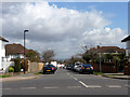
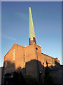
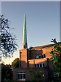
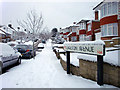
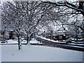
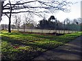
100 photos from this area
Area Information
Key information about the EN4 0BD including its size, population, and administrative classification.
- Area Type
- Postcode
- Area Size
- 3185 m²
- Population
- 1740
- Population Density
- 2807 people/km²
House Prices in EN4 0BD
8
Properties
£788,000
Average Sold Price
£445,000
Lowest Price
£925,000
Highest Price
Showing 8 properties
| Address | Type | Beds | Baths | Last Sale Price | Last Sale Date | |
|---|---|---|---|---|---|---|
| 166 Westpole Avenue, Enfield, EN4 0BD | Detached | 1 | 1 | £880,000 | May 2022 | |
| Greystone, Westpole Avenue, Enfield, EN4 0BD | Semi-detached | 5 | 2 | £925,000 | Apr 2022 | |
| 168 Westpole Avenue, Enfield, EN4 0BD | Terraced | 4 | 2 | £865,000 | Mar 2021 | |
| 164 Westpole Avenue, Enfield, EN4 0BD | house | - | - | £825,000 | Mar 2021 | |
| Woodgrange, Westpole Avenue, Enfield, EN4 0BD | Semi-detached | - | - | £445,000 | Sep 2006 | |
| Church Flat, Samuel House, 1B Westpole Avenue, Enfield, EN4 0BD | Flat | 1 | 1 | - | - | |
| The Hollies, Westpole Avenue, Enfield, EN4 0BD | Semi-detached | - | - | - | - | |
| Doric, Westpole Avenue, Enfield, EN4 0BD | Semi-detached | - | - | - | - |
Energy Efficiency in EN4 0BD
Amenities
Schools
| Rank | School | Type | Entry gender | Ages |
|---|
Explore more schools in this area
Go to Schools tabDemographics
Household Size
Family (3-5 people)
most common
Accommodation Type
Houses
most common
Tenure
63
majority
Ethnic Group
White
most common
Religion
N/A
most common
Household Composition
N/A
most common
Age
47
median
Adults (30-64 years)
most common
Household Deprivation
N/A
with no deprivation
NS-SEC
38
in Lower managerial occupations
Explore more demographic insights in this area
Go to Demographics tabPlanning
Planning Constraints
- Flood RiskPremium
- Ramsar Wetland SitesPremium
- Area of Outstanding Natural BeautyPremium
- Protected Nature ReservePremium
- Protected WoodlandPremium