Area Overview for EN3 7TP
Photos of EN3 7TP

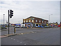

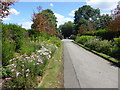
48 photos from this area
Area Information
Key information about the EN3 7TP including its size, population, and administrative classification.
- Area Type
- Postcode
- Area Size
- 1872 m²
- Population
- 2275
- Population Density
- 861 people/km²
House Prices in EN3 7TP
50
Properties
£160,506
Average Sold Price
£140,000
Lowest Price
£175,000
Highest Price
Showing 50 properties
| Address | Type | Beds | Baths | Last Sale Price | Last Sale Date | |
|---|---|---|---|---|---|---|
| 91, Ashcombe House, Exeter Road, Enfield, EN3 7TP | Flat | 1 | 1 | £175,000 | Jul 2017 | |
| 124, Ashcombe House, Exeter Road, Enfield, EN3 7TP | Flat | - | - | £140,000 | Jun 2017 | |
| 32, Ashcombe House, Exeter Road, Enfield, EN3 7TP | Flat | - | - | £160,000 | Dec 2015 | |
| 12, Ashcombe House, Exeter Road, Enfield, EN3 7TP | Flat | - | - | £167,024 | Apr 2015 | |
| 94, Ashcombe House, Exeter Road, Enfield, EN3 7TP | Flat | - | - | - | - | |
| 74, Ashcombe House, Exeter Road, Enfield, EN3 7TP | Flat | - | - | - | - | |
| 123, Ashcombe House, Exeter Road, Enfield, EN3 7TP | Flat | 2 | 1 | - | - | |
| 34, Ashcombe House, Exeter Road, Enfield, EN3 7TP | Flat | - | - | - | - | |
| 92, Ashcombe House, Exeter Road, Enfield, EN3 7TP | Flat | - | - | - | - | |
| 1, Ashcombe House, Exeter Road, Enfield, EN3 7TP | Flat | - | - | - | - |
Page 1 of 5
Energy Efficiency in EN3 7TP
Amenities
Schools
| Rank | School | Type | Entry gender | Ages |
|---|
Explore more schools in this area
Go to Schools tabDemographics
Household Size
Family (3-5 people)
most common
Accommodation Type
Flats
most common
Tenure
30
majority
Ethnic Group
White
most common
Religion
N/A
most common
Household Composition
N/A
most common
Age
47
median
Adults (30-64 years)
most common
Household Deprivation
N/A
with no deprivation
NS-SEC
19
in Lower managerial occupations
Explore more demographic insights in this area
Go to Demographics tabPlanning
Planning Constraints
- Flood RiskPremium
- Ramsar Wetland SitesPremium
- Area of Outstanding Natural BeautyPremium
- Protected Nature ReservePremium
- Protected WoodlandPremium