Area Overview for EN3 7TD
Photos of EN3 7TD


Area Information
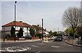
Living in EN3 7TD means being part of a tightly knit residential cluster in north-east London, where 2,275 people reside across 861 people per square kilometre. This small postcode area is defined by its compact layout, with a focus on flats rather than detached homes. The community is predominantly adults aged 30–64, creating a stable, mature demographic. Daily life here is shaped by proximity to transport hubs and retail amenities, with Brimsdown Station and nearby supermarkets within practical reach. While the area lacks natural landscapes or protected sites, it offers a straightforward, functional living environment. The broadband score of 99 ensures seamless internet access, supporting remote work or online activities. However, the crime risk is medium, with a safety score of 50, requiring standard security measures. EN3 7TD is not a place for those seeking luxury or sprawling green spaces but suits those prioritising convenience, connectivity, and affordability in a well-served urban setting.
- Area Type
- Postcode
- Area Size
- Not available
- Population
- 2275
- Population Density
- 861 people/km²
EN3 7TD’s property market is characterised by a 30% home ownership rate, indicating that most residents are renters. The accommodation type is exclusively flats, reflecting the area’s high population density of 861 people per square kilometre. This suggests a lack of detached or semi-detached housing, making the area more suited to tenants than buyers seeking owner-occupied properties. The small postcode area’s limited size means the housing stock is concentrated, with little variation in property types. For buyers, this presents challenges: the market is not geared toward investment or family homes, and the dominance of flats may limit appeal to those preferring larger or more private spaces. However, the area’s proximity to transport and amenities could offset its lack of traditional housing options, making it attractive to commuters or those prioritising convenience over property type.
House Prices in EN3 7TD
No properties found in this postcode.
Energy Efficiency in EN3 7TD
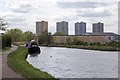
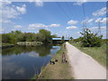
The lifestyle in EN3 7TD is shaped by its proximity to retail and transport hubs. Nearby supermarkets like M&S Highway BP and Co-op Hertford provide everyday shopping convenience, while Makro Enfield caters to larger purchases. The five rail stations, including Brimsdown and Ponders End, offer easy access to central London and surrounding areas. Metro stations like Loughton and Buckhurst Hill further expand commuting options. The Whipps Cross Bus Interchange connects residents to broader networks. While the area lacks parks or leisure facilities, its practical amenities make it suitable for those prioritising efficiency over recreation. The compact layout means amenities are within walking or short transit distance, reducing the need for a car. This convenience, combined with strong retail and transport links, supports a functional, urban lifestyle focused on accessibility rather than expansive leisure opportunities.
Amenities
Schools
EN3 7TD is served by two primary schools: Brimsdown Junior School and Brimsdown Infant School. Both cater to younger children, providing a foundation for local families. The absence of secondary schools in the immediate area means students may need to travel to nearby postcodes for further education. The presence of two primary schools suggests a focus on early education, though the lack of data on Ofsted ratings or academic performance leaves gaps in understanding their quality. For families with young children, the proximity of these schools is a practical advantage, reducing commuting time. However, the absence of secondary schooling options may influence decisions about long-term residency, particularly for households planning for older children. The school mix reflects a community where primary education is prioritised, but secondary needs require external solutions.
| Rank | School | Type | Entry gender | Ages |
|---|
Explore more schools in this area
Go to Schools tabDemographics
EN3 7TD’s population of 2,275 is densely packed at 861 people per square kilometre, reflecting a compact, urban layout. The median age of 47 indicates a mature community, with the majority of residents aged 30–64. Home ownership is low at 30%, suggesting most residents are renters, likely drawn by the area’s affordability. The accommodation type is predominantly flats, aligning with the high population density. The predominant ethnic group is White, with no specific data on other demographics. This age profile implies a stable, working-age population, though the lack of younger families may limit demand for primary schools. The absence of detailed diversity statistics means the community’s social fabric remains less defined. For buyers, the rental-heavy market and flat-centric housing stock suggest limited scope for long-term property investment, though it may appeal to those seeking short-term or starter homes.
Household Size
Accommodation Type
Tenure
Ethnic Group
Religion
Household Composition
Age
Household Deprivation
NS-SEC
Explore more demographic insights in this area
Go to Demographics tabPlanning
Planning Constraints
- Flood RiskPremium
- Ramsar Wetland SitesPremium
- Area of Outstanding Natural BeautyPremium
- Protected Nature ReservePremium
- Protected WoodlandPremium