Area Overview for EN3 7HL
Photos of EN3 7HL
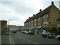
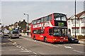
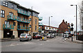

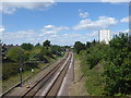
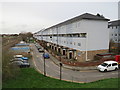
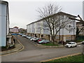
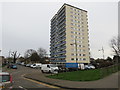
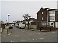
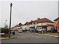
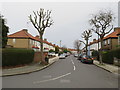
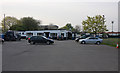
38 photos from this area
Area Information
Key information about the EN3 7HL including its size, population, and administrative classification.
- Area Type
- Postcode
- Area Size
- 7630 m²
- Population
- 2131
- Population Density
- 10148 people/km²
House Prices in EN3 7HL
58
Properties
£184,607
Average Sold Price
£69,000
Lowest Price
£295,000
Highest Price
Showing 58 properties
| Address | Type | Beds | Baths | Last Sale Price | Last Sale Date | |
|---|---|---|---|---|---|---|
| 27 Glenloch Road, Enfield, EN3 7HL | Flat | 2 | 1 | £275,000 | Aug 2025 | |
| 53 Glenloch Road, Enfield, EN3 7HL | Flat | 2 | 1 | £273,000 | Feb 2025 | |
| 63 Glenloch Road, Enfield, EN3 7HL | Maisonette | 2 | 1 | £283,000 | Feb 2024 | |
| 79 Glenloch Road, Enfield, EN3 7HL | Maisonette | 2 | 1 | £290,000 | Oct 2022 | |
| 67 Glenloch Road, Enfield, EN3 7HL | Maisonette | 2 | 1 | £169,500 | Sep 2022 | |
| 47 Glenloch Road, Enfield, EN3 7HL | Flat | 2 | 1 | £295,000 | Feb 2018 | |
| 69 Glenloch Road, Enfield, EN3 7HL | Flat | 2 | 1 | £220,000 | Oct 2017 | |
| 19 Glenloch Road, Enfield, EN3 7HL | Maisonette | 2 | 1 | £275,000 | Jul 2017 | |
| 35 Glenloch Road, Enfield, EN3 7HL | Flat | 2 | 1 | £265,000 | Oct 2016 | |
| 13 Glenloch Road, Enfield, EN3 7HL | Maisonette | 2 | 1 | £249,995 | Dec 2015 |
Page 1 of 6
Energy Efficiency in EN3 7HL
Amenities
Schools
| Rank | School | Type | Entry gender | Ages |
|---|
Explore more schools in this area
Go to Schools tabDemographics
Household Size
Family (3-5 people)
most common
Accommodation Type
Flats
most common
Tenure
29
majority
Ethnic Group
White
most common
Religion
N/A
most common
Household Composition
N/A
most common
Age
47
median
Adults (30-64 years)
most common
Household Deprivation
N/A
with no deprivation
NS-SEC
19
in Lower managerial occupations
Explore more demographic insights in this area
Go to Demographics tabPlanning
Planning Constraints
- Flood RiskPremium
- Ramsar Wetland SitesPremium
- Area of Outstanding Natural BeautyPremium
- Protected Nature ReservePremium
- Protected WoodlandPremium