Area Overview for EN3 7HB
Photos of EN3 7HB


Area Information
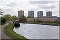
Living in EN3 7HB means inhabiting a tightly packed residential cluster in England, where 2,275 residents share a population density of 861 people per square kilometre. This is a small, defined area with a distinct character shaped by its proximity to local amenities and transport hubs. The community is largely composed of adults aged 30-64, reflecting a mature demographic with established routines. Daily life here is punctuated by the presence of nearby schools, retail outlets, and multiple transport options, making it practical for commuters and families alike. While the area lacks large-scale natural features, its strategic location near Brimsdown and Ponders End stations ensures easy access to broader London networks. The low flood risk and absence of protected land designations suggest a stable, low-constraint environment. However, the medium crime risk score of 50 means residents should remain vigilant. EN3 7HB is not a sprawling suburb but a focused, compact postcode where convenience and proximity to services are key.
- Area Type
- Postcode
- Area Size
- Not available
- Population
- 2275
- Population Density
- 861 people/km²
EN3 7HB’s property market is characterised by a rental-heavy landscape, with only 30% of homes owner-occupied. The accommodation type is predominantly flats, suggesting a housing stock designed for urban density rather than single-family living. This makes the area more attractive to renters, particularly professionals or those requiring short-term housing. The small postcode area means property options are limited, and buyers may need to look beyond EN3 7HB’s immediate boundaries for larger or more varied housing stock. The high proportion of flats may also indicate a lack of new-build developments or a focus on existing housing conversions. For those considering ownership, the market’s tightness could mean competition for available properties, though the absence of planning constraints or protected land designations may simplify the buying process.
House Prices in EN3 7HB
No properties found in this postcode.
Energy Efficiency in EN3 7HB
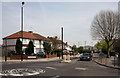
EN3 7HB offers a range of amenities within walking or short-vehicle distance. Retail options include Makro Enfield, M&S Highway BP, and Tesco Enfield, providing essential shopping and dining choices. The area’s transport network is its defining feature, with multiple rail and metro stations offering easy access to London’s broader transport system. The presence of Brimsdown Station and Roding Valley Underground Station ensures convenient connections to key destinations. While parks and leisure facilities are not explicitly listed, the proximity to transport hubs suggests access to nearby green spaces. The combination of retail, transport, and local schools creates a practical lifestyle, though the area’s compact size means larger amenities may require travel beyond the immediate postcode.
Amenities
Schools
EN3 7HB is served by two primary schools: Brimsdown Junior School and Brimsdown Infant School. Both cater to younger children, providing early education within the area. The absence of secondary schools nearby means families with older children would need to rely on commuting to other parts of the borough. The presence of two primary schools suggests a focus on local education, though the lack of Ofsted ratings or performance data means potential buyers must investigate further to assess quality. For those prioritising proximity to schools, the availability of primary education is a practical advantage, but the absence of secondary options may be a limitation for larger families.
| Rank | School | Type | Entry gender | Ages |
|---|
Explore more schools in this area
Go to Schools tabDemographics
EN3 7HB has a median age of 47, with the majority of residents falling into the 30-64 age bracket. This suggests a community of working-age adults and older professionals, rather than a family-heavy or student-dominated area. Only 30% of households are owner-occupied, indicating a rental market dominance. The accommodation type is predominantly flats, reflecting a housing stock suited to urban living rather than detached homes. The predominant ethnic group is White, which aligns with broader regional patterns but offers limited insight into cultural diversity. The absence of specific deprivation data means quality of life factors such as access to amenities and services are critical to understanding daily life. With a population density of 861 people per square kilometre, the area is compact, which may influence social dynamics and community cohesion.
Household Size
Accommodation Type
Tenure
Ethnic Group
Religion
Household Composition
Age
Household Deprivation
NS-SEC
Explore more demographic insights in this area
Go to Demographics tabPlanning
Planning Constraints
- Flood RiskPremium
- Ramsar Wetland SitesPremium
- Area of Outstanding Natural BeautyPremium
- Protected Nature ReservePremium
- Protected WoodlandPremium