Area Overview for EN3 7AE
Photos of EN3 7AE
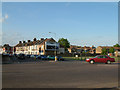

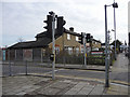
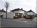
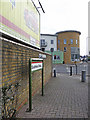
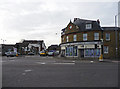
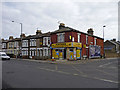
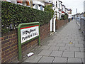
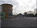
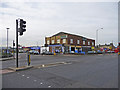
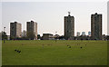
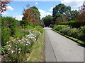
48 photos from this area
Area Information
Key information about the EN3 7AE including its size, population, and administrative classification.
- Area Type
- Postcode
- Area Size
- 8309 m²
- Population
- 1773
- Population Density
- 12169 people/km²
House Prices in EN3 7AE
40
Properties
£186,581
Average Sold Price
£59,995
Lowest Price
£426,500
Highest Price
Showing 40 properties
| Address | Type | Beds | Baths | Last Sale Price | Last Sale Date | |
|---|---|---|---|---|---|---|
| 199 Nags Head Road, Enfield, EN3 7AE | house | 3 | 1 | £300,000 | Oct 2025 | |
| 213 Nags Head Road, Enfield, EN3 7AE | Retail | 3 | 1 | £426,500 | May 2022 | |
| 215 Nags Head Road, Enfield, EN3 7AE | Terraced | 4 | 1 | £385,000 | Jun 2021 | |
| 193 NAGS HEAD ROAD, Enfield, EN3 7AE | Flat | 3 | 1 | £347,500 | May 2017 | |
| 229 Nags Head Road, Enfield, EN3 7AE | Flat | - | - | £300,000 | Dec 2015 | |
| 205 Nags Head Road, Enfield, EN3 7AE | house | - | - | £210,000 | Nov 2005 | |
| 211 Nags Head Road, Enfield, EN3 7AE | house | 3 | 1 | £188,000 | Jun 2004 | |
| 217 Nags Head Road, Enfield, EN3 7AE | house | - | - | £145,000 | May 2002 | |
| 249 Nags Head Road, Enfield, EN3 7AE | house | - | - | £123,000 | Apr 2002 | |
| 231 Nags Head Road, Enfield, EN3 7AE | Terraced | - | - | £119,000 | Mar 2001 |
Page 1 of 4
Energy Efficiency in EN3 7AE
Amenities
Schools
| Rank | School | Type | Entry gender | Ages |
|---|
Explore more schools in this area
Go to Schools tabDemographics
Household Size
Family (3-5 people)
most common
Accommodation Type
Houses
most common
Tenure
39
majority
Ethnic Group
White
most common
Religion
N/A
most common
Household Composition
N/A
most common
Age
47
median
Adults (30-64 years)
most common
Household Deprivation
N/A
with no deprivation
NS-SEC
20
in Lower managerial occupations
Explore more demographic insights in this area
Go to Demographics tabPlanning
Planning Constraints
- Flood RiskPremium
- Ramsar Wetland SitesPremium
- Area of Outstanding Natural BeautyPremium
- Protected Nature ReservePremium
- Protected WoodlandPremium