Area Overview for EN3 5LL
Photos of EN3 5LL
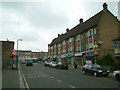
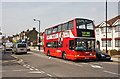
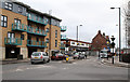
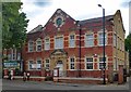
38 photos from this area
Area Information
Key information about the EN3 5LL including its size, population, and administrative classification.
- Area Type
- Postcode
- Area Size
- 6041 m²
- Population
- 2131
- Population Density
- 10148 people/km²
House Prices in EN3 5LL
20
Properties
£272,550
Average Sold Price
£88,000
Lowest Price
£540,000
Highest Price
Showing 20 properties
| Address | Type | Beds | Baths | Last Sale Price | Last Sale Date | |
|---|---|---|---|---|---|---|
| 53 Oatlands Road, Enfield, EN3 5LL | Semi-detached | 4 | 2 | £540,000 | Aug 2024 | |
| 37 Oatlands Road, Enfield, EN3 5LL | Terraced | 3 | 1 | £440,000 | Mar 2024 | |
| 41 Oatlands Road, Enfield, EN3 5LL | Terraced | 3 | 1 | £425,000 | Nov 2022 | |
| 55 Oatlands Road, Enfield, EN3 5LL | house | 3 | 2 | £430,000 | Dec 2016 | |
| 47 Oatlands Road, Enfield, EN3 5LL | Semi-detached | 3 | 1 | £232,500 | Sep 2011 | |
| 39 Oatlands Road, Enfield, EN3 5LL | Terraced | - | - | £226,000 | Aug 2006 | |
| 42 Oatlands Road, Enfield, EN3 5LL | Semi-detached | 3 | - | £158,000 | Dec 2001 | |
| 50 Oatlands Road, Enfield, EN3 5LL | Semi-detached | - | - | £98,000 | May 1998 | |
| 51 Oatlands Road, Enfield, EN3 5LL | Semi-detached | 5 | 2 | £88,000 | May 1997 | |
| 49 Oatlands Road, Enfield, EN3 5LL | Terraced | - | - | £88,000 | Jan 1997 |
Page 1 of 2
Energy Efficiency in EN3 5LL
Amenities
Schools
| Rank | School | Type | Entry gender | Ages |
|---|
Explore more schools in this area
Go to Schools tabDemographics
Household Size
Family (3-5 people)
most common
Accommodation Type
Flats
most common
Tenure
29
majority
Ethnic Group
White
most common
Religion
N/A
most common
Household Composition
N/A
most common
Age
47
median
Adults (30-64 years)
most common
Household Deprivation
N/A
with no deprivation
NS-SEC
19
in Lower managerial occupations
Explore more demographic insights in this area
Go to Demographics tabPlanning
Planning Constraints
- Flood RiskPremium
- Ramsar Wetland SitesPremium
- Area of Outstanding Natural BeautyPremium
- Protected Nature ReservePremium
- Protected WoodlandPremium