Area Overview for EN3 4NB
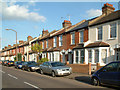
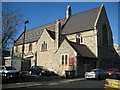
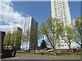
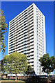
Photos of EN3 4NB


Area Information
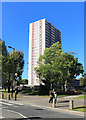
EN3 4NB is a small residential postcode area in England, home to 1954 residents. It occupies a compact cluster of properties, offering a quiet, community-focused environment. The area’s proximity to multiple rail and metro stations, including Ponders End and Buckhurst Hill, ensures easy access to London’s transport network. Daily life here is shaped by a balance of local amenities and connectivity. Residents benefit from nearby shops, such as Tesco Enfield and Farmfoods Ponders, as well as a range of public transport options. The area’s demographic profile suggests a mature population, with a median age of 47 and a strong presence of adults aged 30–64. While it lacks large-scale commercial hubs, its compact size fosters a sense of familiarity and convenience for those prioritising accessibility over sprawling urban spaces. For buyers, EN3 4NB represents a blend of practicality and proximity, with homes primarily in house formats. The area’s character is defined by its modest scale and integration with surrounding transport corridors, making it suitable for commuters or those seeking a base near London’s outer suburbs.
- Area Type
- Postcode
- Area Size
- Not available
- Population
- 1954
- Population Density
- 6961 people/km²
EN3 4NB’s property market is characterised by a 49% home ownership rate, indicating a balance between owner-occupied and rental properties. The predominant accommodation type is houses, which suggests a focus on family homes or semi-detached properties. This contrasts with areas dominated by flats or high-density housing. The small population and compact size of the area mean the housing stock is limited, potentially leading to competition among buyers. For those seeking homes in EN3 4NB, the availability of houses may appeal to families or individuals preferring more space. However, the relatively low home ownership rate implies a significant portion of the housing stock is rented, which could affect market dynamics. Buyers should consider the area’s proximity to transport links and amenities when evaluating property value. The small scale of the area also means that property prices may reflect local demand rather than broader regional trends.
House Prices in EN3 4NB
No properties found in this postcode.
Energy Efficiency in EN3 4NB
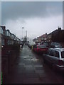
Living in EN3 4NB offers access to a range of practical amenities within reach. Retail options include Tesco Enfield, Budgens Mottingham, and Farmfoods Ponders, providing everyday shopping needs. The area’s proximity to multiple rail and metro stations, such as Brimsdown and Southgate, ensures easy travel to nearby towns and London. While there are no named parks or leisure facilities in the data, the presence of transport hubs suggests opportunities for recreation in nearby areas. The compact nature of the postcode means residents can walk or cycle to nearby amenities, enhancing convenience. The mix of retail and transport options supports a lifestyle focused on accessibility and efficiency. For those prioritising ease of movement and local services, EN3 4NB offers a functional base with minimal need for long commutes.
Amenities
Schools
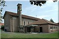
The nearest school to EN3 4NB is St Matthew’s CofE Primary School, which provides education for younger children. The school is rated ‘good’ by Ofsted, indicating a satisfactory standard of teaching and facilities. As a primary school, it serves the immediate community, offering a local option for families with young children. The absence of secondary schools in the data suggests that residents may need to travel further for secondary education, potentially to nearby towns or cities. The presence of a ‘good’-rated primary school is a positive factor for families prioritising early education, though the lack of secondary options could be a consideration for those planning long-term schooling. The school’s rating reflects its ability to meet educational standards, but parents should explore additional resources or commuting options for secondary education.
| Rank | School | Type | Entry gender | Ages |
|---|---|---|---|---|
| 1 | St Matthew's CofE Primary School | primary | N/A | N/A |
Explore more schools in this area
Go to Schools tabDemographics
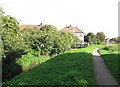
The population of EN3 4NB is 1954, with a median age of 47. The majority of residents fall within the 30–64 age range, suggesting a community of working-age adults and families. Home ownership stands at 49%, indicating a mix of owner-occupied and rental properties. The predominant accommodation type is houses, reflecting a suburban or semi-rural character. The area’s ethnic composition is largely White, with no specific data provided on other groups. The population size is small enough to foster a tight-knit community but large enough to support basic amenities. Deprivation data is not explicitly provided, but the presence of multiple retail outlets and transport links implies a reasonable standard of living. The age profile suggests a stable, established population, with fewer young families or elderly residents compared to other areas. This demographic structure may influence local services and social dynamics, with a focus on adult-oriented needs.
Household Size
Accommodation Type
Tenure
Ethnic Group
Religion
Household Composition
Age
Household Deprivation
NS-SEC
Explore more demographic insights in this area
Go to Demographics tabPlanning
Planning Constraints
- Flood RiskPremium
- Ramsar Wetland SitesPremium
- Area of Outstanding Natural BeautyPremium
- Protected Nature ReservePremium
- Protected WoodlandPremium
- Crime RiskPremium