Area Overview for EN2 8JL
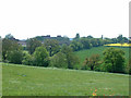
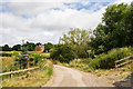
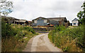
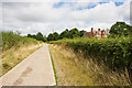
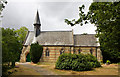
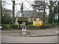
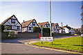
Photos of EN2 8JL
Area Information
EN2 8JL is a compact residential cluster in England, covering just 7.3 hectares and home to 1,416 residents. With a population density of 19,528 people per square kilometre, it is a densely populated area characterised by a mix of family homes and a mature demographic. The median age of 47 suggests a community of established residents, many of whom are in the 30–64 age bracket. This area is primarily owner-occupied, with 68% of homes in private hands, and the predominant ethnic group is White. Daily life here is shaped by proximity to transport hubs and local amenities, with rail and metro stations within practical reach. While the area lacks natural reserves or protected landscapes, its compact size means residents can access shops, schools, and public transport without long commutes. The high population density and focused housing stock create a tight-knit environment, though buyers should consider the small area’s limitations for future expansion.
- Area Type
- Postcode
- Area Size
- 7.3 hectares
- Population
- Not available
- Population Density
- Not available
EN2 8JL is a small, owner-occupied area where 68% of homes are privately owned, with a focus on houses rather than flats. This suggests a market tailored to families or individuals seeking more space, though the limited area size means housing stock is constrained. The high population density—19,528 people per square kilometre—indicates that properties are closely packed, which could impact availability for buyers seeking larger homes or land. The area’s compact nature means that any new developments would likely be limited to existing housing stock, making it a competitive market for those prioritising proximity to transport and amenities. For buyers, the focus on houses may appeal to those looking for traditional family homes, but the small size of the area means expansion options are minimal.
House Prices in EN2 8JL
Showing 12 properties
| Address | Type | Beds | Baths | Last Sale Price | Last Sale Date | |
|---|---|---|---|---|---|---|
| Pharmacy, Chase Farm Hospital, The Ridgeway, Enfield, EN2 8JL | shop | - | - | - | - | |
| Highlands Wing, Chase Farm Hospital, The Ridgeway, Enfield, EN2 8JL | hospital_care_home | - | - | - | - | |
| Energy Centre, Chase Farm Hospital, The Ridgeway, Enfield, EN2 8JL | commercial | - | - | - | - | |
| The Cataract Centre Clinic, Chase Farm Hospital, The Ridgeway, Enfield, EN2 8JL | commercial | - | - | - | - | |
| Clock Tower Cafe, Chase Farm Hospital, The Ridgeway, Enfield, EN2 8JL | Restaurant | - | - | - | - | |
| The Oaks, Chase Farm Hospital, The Ridgeway, Enfield, EN2 8JL | hospital_care_home | - | - | - | - | |
| Devon Ward, Chase Farm Hospital, The Ridgeway, Enfield, EN2 8JL | commercial | - | - | - | - | |
| Psychiatric Ward, Chase Farm Hospital, The Ridgeway, Enfield, EN2 8JL | commercial | - | - | - | - | |
| Silver Birches, Chase Farm Hospital, The Ridgeway, Enfield, EN2 8JL | commercial | - | - | - | - | |
| Shop, Chase Farm Hospital, The Ridgeway, Enfield, EN2 8JL | shop | - | - | - | - |
Energy Efficiency in EN2 8JL
EN2 8JL’s residents have access to a range of amenities within walking or short driving distance. Retail options include multiple Co-ops and a Waitrose, providing everyday shopping convenience. The area’s proximity to rail and metro stations—such as Gordon Hill, Enfield Chase, and Oakwood—facilitates easy travel to nearby towns and cities. While specific parks or leisure facilities are not detailed in the data, the area’s compact nature suggests that residents may rely on nearby green spaces or community hubs for recreation. The presence of multiple retail and transport hubs indicates a practical, efficient lifestyle, though the lack of named parks or leisure venues means buyers may need to consider additional travel for outdoor activities.
Amenities
Schools
Residents of EN2 8JL have access to two academies within reach: One Degree Academy, rated outstanding by Ofsted, and Wren Academy Enfield, rated good. These institutions offer a range of educational options, with the outstanding rating suggesting high-quality teaching and facilities at One Degree Academy. The presence of two academies provides families with choices, though the specific curriculum or specialisms of each school are not detailed. The proximity of these schools to the area is a key advantage for families, reducing travel times and ensuring access to education. Given the area’s population density and focus on houses, it is likely that these schools serve a significant proportion of the local community.
| Rank | School | Type | Entry gender | Ages |
|---|
Explore more schools in this area
Go to Schools tabDemographics
EN2 8JL’s population of 1,416 is predominantly composed of adults aged 30–64, with a median age of 47. This suggests a community of long-term residents, many of whom may be in their prime working years or nearing retirement. Home ownership is strong, with 68% of properties owned by residents, indicating a stable housing market. The area is primarily composed of houses rather than flats, which aligns with the demographic profile of families or individuals seeking more space. The predominant ethnic group is White, though no specific data on diversity or deprivation levels is provided. The high population density—19,528 people per square kilometre—means the area is tightly packed, which may influence the pace of life and the availability of communal spaces. This density also suggests a reliance on shared amenities and transport networks to meet daily needs.
Household Size
Accommodation Type
Tenure
Ethnic Group
Religion
Household Composition
Age
Household Deprivation
NS-SEC
Explore more demographic insights in this area
Go to Demographics tabPlanning
Planning Constraints
- Flood RiskPremium
- Ramsar Wetland SitesPremium
- Area of Outstanding Natural BeautyPremium
- Protected Nature ReservePremium
- Protected WoodlandPremium