Area Overview for EN2 8BX
Photos of EN2 8BX
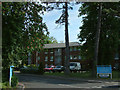
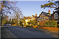
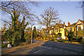
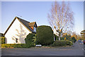
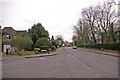
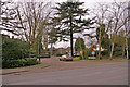
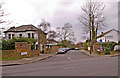
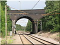
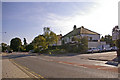
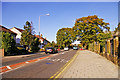
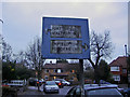
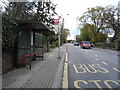
98 photos from this area
Area Information
Key information about the EN2 8BX including its size, population, and administrative classification.
- Area Type
- Postcode
- Area Size
- 9474 m²
- Population
- 1767
- Population Density
- 7864 people/km²
House Prices in EN2 8BX
21
Properties
£229,438
Average Sold Price
£85,000
Lowest Price
£420,000
Highest Price
Showing 21 properties
| Address | Type | Beds | Baths | Last Sale Price | Last Sale Date | |
|---|---|---|---|---|---|---|
| 177 Holtwhites Hill, Enfield, EN2 8BX | house | 3 | - | £295,000 | Jan 2014 | |
| 211 Holtwhites Hill, Enfield, EN2 8BX | house | 3 | - | £420,000 | Jun 2012 | |
| 173 Holtwhites Hill, Enfield, EN2 8BX | house | - | - | £280,000 | Jan 2011 | |
| 189 Holtwhites Hill, Enfield, EN2 8BX | Terraced | - | - | £226,500 | May 2006 | |
| 217 Holtwhites Hill, Enfield, EN2 8BX | Semi-detached | - | - | £248,000 | Aug 2000 | |
| 185 Holtwhites Hill, Enfield, EN2 8BX | Terraced | 3 | 2 | £136,000 | Mar 2000 | |
| 179 Holtwhites Hill, Enfield, EN2 8BX | house | - | - | £145,000 | Oct 1997 | |
| 167 Holtwhites Hill, Enfield, EN2 8BX | house | - | - | £85,000 | Feb 1997 | |
| 181 Holtwhites Hill, Enfield, EN2 8BX | Semi-detached | - | - | - | - | |
| 175 Holtwhites Hill, Enfield, EN2 8BX | Terraced | - | - | - | - |
Page 1 of 3
Energy Efficiency in EN2 8BX
Amenities
Schools
| Rank | School | Type | Entry gender | Ages |
|---|
Explore more schools in this area
Go to Schools tabDemographics
Household Size
Family (3-5 people)
most common
Accommodation Type
Houses
most common
Tenure
64
majority
Ethnic Group
White
most common
Religion
N/A
most common
Household Composition
N/A
most common
Age
47
median
Adults (30-64 years)
most common
Household Deprivation
N/A
with no deprivation
NS-SEC
38
in Lower managerial occupations
Explore more demographic insights in this area
Go to Demographics tabPlanning
Planning Constraints
- Flood RiskPremium
- Ramsar Wetland SitesPremium
- Area of Outstanding Natural BeautyPremium
- Protected Nature ReservePremium
- Protected WoodlandPremium