Area Overview for EN2 7PX
Photos of EN2 7PX
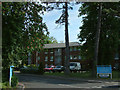
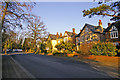
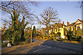
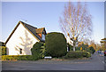
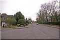
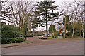
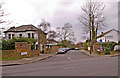
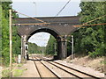
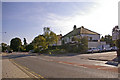
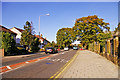
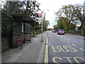
98 photos from this area
Area Information
Key information about the EN2 7PX including its size, population, and administrative classification.
- Area Type
- Postcode
- Area Size
- 4413 m²
- Population
- 1649
- Population Density
- 870 people/km²
House Prices in EN2 7PX
8
Properties
£335,624
Average Sold Price
£97,000
Lowest Price
£650,000
Highest Price
Showing 8 properties
| Address | Type | Beds | Baths | Last Sale Price | Last Sale Date | |
|---|---|---|---|---|---|---|
| 17 The Grove, Enfield, EN2 7PX | Bungalow | 2 | 1 | £592,000 | Jun 2023 | |
| 15 The Grove, Enfield, EN2 7PX | house | - | - | £650,000 | Jan 2020 | |
| 9 The Grove, Enfield, EN2 7PX | Bungalow | - | - | £368,000 | Feb 2012 | |
| 13 The Grove, Enfield, EN2 7PX | Detached | - | - | £499,995 | Feb 2002 | |
| 21 The Grove, Enfield, EN2 7PX | Semi-detached | - | - | £164,000 | Nov 2001 | |
| 23 The Grove, Enfield, EN2 7PX | Bungalow | - | - | £174,000 | Nov 2001 | |
| 15A The Grove, Enfield, EN2 7PX | Semi-detached | - | - | £140,000 | Jul 1996 | |
| 11 The Grove, Enfield, EN2 7PX | Bungalow | 2 | 1 | £97,000 | Apr 1995 |
Energy Efficiency in EN2 7PX
Amenities
Schools
| Rank | School | Type | Entry gender | Ages |
|---|
Explore more schools in this area
Go to Schools tabDemographics
Household Size
Family (3-5 people)
most common
Accommodation Type
Houses
most common
Tenure
82
majority
Ethnic Group
White
most common
Religion
N/A
most common
Household Composition
N/A
most common
Age
47
median
Adults (30-64 years)
most common
Household Deprivation
N/A
with no deprivation
NS-SEC
43
in Lower managerial occupations
Explore more demographic insights in this area
Go to Demographics tabPlanning
Planning Constraints
- Flood RiskPremium
- Ramsar Wetland SitesPremium
- Area of Outstanding Natural BeautyPremium
- Protected Nature ReservePremium
- Protected WoodlandPremium