Area Overview for EN2 6TJ
Photos of EN2 6TJ


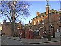
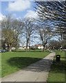
100 photos from this area
Area Information
Key information about the EN2 6TJ including its size, population, and administrative classification.
- Area Type
- Postcode
- Area Size
- 5.3 hectares
- Population
- Not available
- Population Density
- Not available
House Prices in EN2 6TJ
27
Properties
£514,429
Average Sold Price
£41,000
Lowest Price
£830,000
Highest Price
Showing 27 properties
| Address | Type | Beds | Baths | Last Sale Price | Last Sale Date | |
|---|---|---|---|---|---|---|
| 41 Cecil Road, Enfield, EN2 6TJ | Semi-detached | 5 | 2 | £830,000 | Dec 2023 | |
| 31 Cecil Road, Enfield, EN2 6TJ | Detached | 4 | - | £750,000 | May 2023 | |
| 85 Cecil Road, Enfield, EN2 6TJ | house | 2 | 1 | £590,000 | Jan 2021 | |
| 45 Cecil Road, Enfield, EN2 6TJ | Semi-detached | 4 | 2 | £739,000 | Jun 2019 | |
| 57 Cecil Road, Enfield, EN2 6TJ | Bungalow | 3 | 1 | £600,000 | Dec 2017 | |
| 83 Cecil Road, Enfield, EN2 6TJ | Semi-detached | 3 | 1 | £486,000 | Apr 2015 | |
| 51 Cecil Road, Enfield, EN2 6TJ | Semi-detached | 6 | 1 | £590,000 | Feb 2014 | |
| 49 Cecil Road, Enfield, EN2 6TJ | house | 4 | 2 | £495,000 | May 2013 | |
| 53 Cecil Road, Enfield, EN2 6TJ | Detached | 3 | 1 | £680,000 | Jun 2012 | |
| 33 Cecil Road, Enfield, EN2 6TJ | Flat | - | - | £265,000 | Dec 2006 |
Page 1 of 3
Energy Efficiency in EN2 6TJ
Amenities
Schools
| Rank | School | Type | Entry gender | Ages |
|---|
Explore more schools in this area
Go to Schools tabDemographics
Household Size
Family (3-5 people)
most common
Accommodation Type
Houses
most common
Tenure
74
majority
Ethnic Group
White
most common
Religion
N/A
most common
Household Composition
N/A
most common
Age
47
median
Adults (30-64 years)
most common
Household Deprivation
N/A
with no deprivation
NS-SEC
45
in Lower managerial occupations
Explore more demographic insights in this area
Go to Demographics tabPlanning
Planning Constraints
- Flood RiskPremium
- Ramsar Wetland SitesPremium
- Area of Outstanding Natural BeautyPremium
- Protected Nature ReservePremium
- Protected WoodlandPremium