Area Overview for EN2 6LX
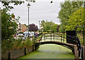
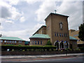
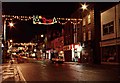
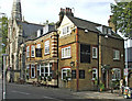
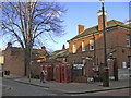
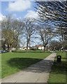
Photos of EN2 6LX


Area Information
EN2 6LX is a compact residential postcode area in England, covering just 592 square metres and home to 2,378 residents. Its high population density—over 4 million people per square kilometre—reflects a tightly packed, urban environment. Daily life here is shaped by its proximity to transport hubs and retail centres, with residents enjoying easy access to multiple rail and metro stations, including Enfield Town and Cockfosters. The area’s character is defined by its mix of older flats, predominantly occupied by renters, and a community skewed toward middle-aged adults aged 30–64. While the postcode’s small size limits expansion, its strategic location near major roads and public transport makes it a practical choice for commuters. The presence of a primary school, Holy Family Covent RC School, adds to its appeal for families, though the area’s compact nature means amenities are closely clustered. For those seeking a balance between urban convenience and a sense of community, EN2 6LX offers a distinct, albeit densely populated, living experience.
- Area Type
- Postcode
- Area Size
- 592 m²
- Population
- Not available
- Population Density
- Not available
EN2 6LX is a rental-focused area, with only 40% of residents owning their homes. The housing stock is dominated by flats, which aligns with the postcode’s small size and urban nature. This suggests a limited supply of larger properties, such as detached homes or semi-detached houses, and a market more suited to buyers seeking investment opportunities in rental properties. The area’s compactness means the immediate surroundings may offer similar housing types, potentially restricting choice for those looking for spacious or unique properties. For buyers, this dynamic implies a need to consider the long-term viability of rental income, given the high proportion of renters. The prevalence of flats also means that property values may be influenced more by location and proximity to transport than by square footage alone.
House Prices in EN2 6LX
No properties found in this postcode.
Energy Efficiency in EN2 6LX
Daily life in EN2 6LX is shaped by its proximity to essential amenities. Retail options include major stores like M&S Enfield, Lidl Enfield, and Iceland Enfield, offering convenience for shopping and groceries. The area’s transport links—five rail stations, five metro stops, and a bus interchange—ensure easy access to nearby towns and attractions. While the small postcode size means amenities are closely clustered, the density of services supports a practical lifestyle. The presence of Holy Family Covent RC School adds to the area’s appeal for families. However, the compact nature of EN2 6LX may mean limited green spaces or leisure facilities, with no data indicating nearby parks or recreational areas. Residents rely heavily on nearby towns for broader leisure options.
Amenities
Schools
The nearest school to EN2 6LX is Holy Family Covent RC School, a primary institution serving the local community. While no Ofsted rating is provided, the presence of a primary school is a key consideration for families with young children. The absence of secondary schools in the data suggests that residents may need to look beyond the immediate area for comprehensive education options. The single primary school available reflects the postcode’s small size and limited infrastructure, which could be a drawback for families requiring a range of educational facilities. However, its proximity to the area makes it a practical choice for parents seeking a local school for their children.
| Rank | School | Type | Entry gender | Ages |
|---|
Explore more schools in this area
Go to Schools tabDemographics
The population of EN2 6LX is 2,378, with a median age of 47, indicating a mature community. The most common age range is adults aged 30–64, suggesting a stable, working-age population. Home ownership here is relatively low, with only 40% of residents owning their homes, while the remaining 60% are likely to be renters. The accommodation type is predominantly flats, reflecting a housing stock suited to urban living. The predominant ethnic group is White, though no specific data on diversity or deprivation is provided. The high population density—over 4 million people per square kilometre—suggests a tightly packed environment, which may influence the area’s character and the availability of private space. This demographic profile indicates a community focused on practical living, with a strong emphasis on proximity to transport and services rather than expansive housing.
Household Size
Accommodation Type
Tenure
Ethnic Group
Religion
Household Composition
Age
Household Deprivation
NS-SEC
Explore more demographic insights in this area
Go to Demographics tabPlanning
Planning Constraints
- Flood RiskPremium
- Ramsar Wetland SitesPremium
- Area of Outstanding Natural BeautyPremium
- Protected Nature ReservePremium
- Protected WoodlandPremium