Area Overview for EN2 0HP
Photos of EN2 0HP


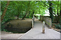
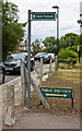

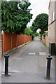
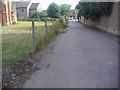
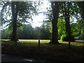
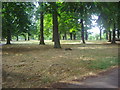


93 photos from this area
Area Information
Key information about the EN2 0HP including its size, population, and administrative classification.
- Area Type
- Postcode
- Area Size
- 1.9 hectares
- Population
- Not available
- Population Density
- Not available
House Prices in EN2 0HP
38
Properties
£399,527
Average Sold Price
£100,000
Lowest Price
£780,000
Highest Price
Showing 38 properties
| Address | Type | Beds | Baths | Last Sale Price | Last Sale Date | |
|---|---|---|---|---|---|---|
| 41 Hillside Crescent, Enfield, EN2 0HP | house | 3 | 2 | £680,000 | Aug 2023 | |
| 73 Hillside Crescent, Enfield, EN2 0HP | house | 4 | 2 | £780,000 | Nov 2022 | |
| 63 Hillside Crescent, Enfield, EN2 0HP | house | - | - | £431,250 | Apr 2021 | |
| 15 Hillside Crescent, Enfield, EN2 0HP | Semi-detached | 4 | 1 | £575,000 | Oct 2020 | |
| 25 Hillside Crescent, Enfield, EN2 0HP | Semi-detached | 4 | 2 | £637,000 | Oct 2020 | |
| 37 Hillside Crescent, Enfield, EN2 0HP | house | 3 | 1 | £595,000 | Nov 2018 | |
| 57 Hillside Crescent, Enfield, EN2 0HP | Semi-detached | 3 | 1 | £520,000 | Mar 2017 | |
| 21 Hillside Crescent, Enfield, EN2 0HP | house | 5 | 1 | £692,000 | Jul 2016 | |
| 53 Hillside Crescent, Enfield, EN2 0HP | house | - | - | £575,000 | Jun 2016 | |
| 61 Hillside Crescent, Enfield, EN2 0HP | house | 3 | 1 | £560,000 | Jan 2016 |
Page 1 of 4
Energy Efficiency in EN2 0HP
Amenities
Schools
| Rank | School | Type | Entry gender | Ages |
|---|
Explore more schools in this area
Go to Schools tabDemographics
Household Size
Family (3-5 people)
most common
Accommodation Type
Houses
most common
Tenure
85
majority
Ethnic Group
White
most common
Religion
N/A
most common
Household Composition
N/A
most common
Age
47
median
Adults (30-64 years)
most common
Household Deprivation
N/A
with no deprivation
NS-SEC
43
in Lower managerial occupations
Explore more demographic insights in this area
Go to Demographics tabPlanning
Planning Constraints
- Flood RiskPremium
- Ramsar Wetland SitesPremium
- Area of Outstanding Natural BeautyPremium
- Protected Nature ReservePremium
- Protected WoodlandPremium