Area Overview for EN2 0DS
Photos of EN2 0DS


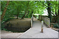
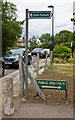

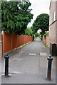
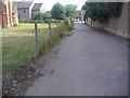


93 photos from this area
Area Information
Key information about the EN2 0DS including its size, population, and administrative classification.
- Area Type
- Postcode
- Area Size
- 1.7 hectares
- Population
- 1593
- Population Density
- 1544 people/km²
House Prices in EN2 0DS
23
Properties
£393,263
Average Sold Price
£79,000
Lowest Price
£745,000
Highest Price
Showing 23 properties
| Address | Type | Beds | Baths | Last Sale Price | Last Sale Date | |
|---|---|---|---|---|---|---|
| 19 Hawthorn Grove, Enfield, EN2 0DS | Terraced | 4 | 3 | £655,000 | Aug 2023 | |
| 50 Hawthorn Grove, Enfield, EN2 0DS | Terraced | 4 | 3 | £745,000 | Sep 2021 | |
| 36 Hawthorn Grove, Enfield, EN2 0DS | house | 3 | - | £470,000 | Jun 2021 | |
| 17 Hawthorn Grove, Enfield, EN2 0DS | Terraced | 4 | 1 | £535,000 | Mar 2021 | |
| 44 Hawthorn Grove, Enfield, EN2 0DS | Terraced | 4 | 2 | £530,000 | Nov 2019 | |
| 46 Hawthorn Grove, Enfield, EN2 0DS | house | 3 | 2 | £500,023 | May 2018 | |
| 42 Hawthorn Grove, Enfield, EN2 0DS | Terraced | 3 | 2 | £525,000 | Jan 2018 | |
| 20 Hawthorn Grove, Enfield, EN2 0DS | house | - | - | £407,500 | Sep 2014 | |
| 15 Hawthorn Grove, Enfield, EN2 0DS | house | - | - | £350,000 | May 2014 | |
| 48 Hawthorn Grove, Enfield, EN2 0DS | house | - | - | £334,950 | Nov 2013 |
Page 1 of 3
Energy Efficiency in EN2 0DS
Amenities
Schools
| Rank | School | Type | Entry gender | Ages |
|---|
Explore more schools in this area
Go to Schools tabDemographics
Household Size
Family (3-5 people)
most common
Accommodation Type
Houses
most common
Tenure
70
majority
Ethnic Group
White
most common
Religion
N/A
most common
Household Composition
N/A
most common
Age
47
median
Adults (30-64 years)
most common
Household Deprivation
N/A
with no deprivation
NS-SEC
33
in Lower managerial occupations
Explore more demographic insights in this area
Go to Demographics tabPlanning
Planning Constraints
- Flood RiskPremium
- Ramsar Wetland SitesPremium
- Area of Outstanding Natural BeautyPremium
- Protected Nature ReservePremium
- Protected WoodlandPremium