Area Overview for EN2 0BY
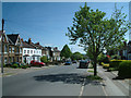
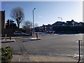
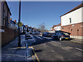
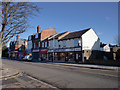
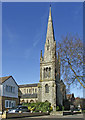
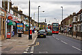
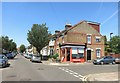
Photos of EN2 0BY

Area Information
Living in EN2 0BY means being part of a tightly packed residential cluster in north London, where 1,903 people reside across 753 square metres. This small area is defined by its proximity to transport networks, with five rail stations and three metro stops within practical reach, including Gordon Hill and Enfield Town. The high population density — 2.5 million people per square kilometre — reflects a compact, community-oriented layout. Daily life here balances urban convenience with suburban tranquillity, with shops like Sainsburys Enfield and Co-op Lancaster within walking distance. The area’s median age of 47 suggests a mix of established residents and families, with a strong focus on home ownership. While the density can feel intense, the availability of nearby amenities and transport links makes EN2 0BY a practical choice for those prioritising connectivity over space.
- Area Type
- Postcode
- Area Size
- 753 m²
- Population
- Not available
- Population Density
- Not available
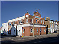
EN2 0BY is predominantly an owner-occupied area, with 70% of homes owned by residents rather than rented. The accommodation type is exclusively houses, which is unusual for a small postcode area but suggests a focus on family-friendly living. Given the high population density and limited area size, the housing stock is likely to be compact and tightly arranged. Buyers should consider that the market is not expansive, with limited scope for new developments. The proximity to rail and metro stations adds value, particularly for commuters. However, the small size of the area means that property choices are constrained, and buyers must weigh the benefits of transport links against the potential for overcrowding or limited private space.
House Prices in EN2 0BY
Showing 1 properties
| Address | Type | Beds | Baths | Last Sale Price | Last Sale Date | |
|---|---|---|---|---|---|---|
| Office, 50 Lancaster Road, Enfield, EN2 0BY | office_workshop | - | - | - | - |
Energy Efficiency in EN2 0BY
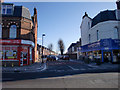
EN2 0BY offers a range of amenities within walking distance, including five retail outlets such as Sainsburys Enfield and Co-op Lancaster. These shops provide essential services, from groceries to household goods. The area’s transport links also grant access to broader leisure opportunities, though specific parks or recreational facilities are not listed in the data. The presence of multiple rail and metro stations enhances convenience, allowing quick travel to nearby towns or London’s cultural hubs. While the area’s compact size limits large-scale amenities, the combination of retail, transport, and proximity to urban centres creates a functional lifestyle. Residents benefit from a balance of practicality and accessibility, with daily needs met by nearby shops and efficient travel options.
Amenities
Schools
| Rank | School | Type | Entry gender | Ages |
|---|
Explore more schools in this area
Go to Schools tabDemographics
EN2 0BY’s population skews towards adults aged 30–64, with a median age of 47. This suggests a community of professionals and families, rather than students or retirees. Home ownership is high at 70%, with houses being the predominant accommodation type. The White ethnic group forms the majority, though specific diversity statistics are not provided. The area’s population density — 2.5 million people per square kilometre — indicates a tightly packed neighbourhood, which can influence local dynamics. While this density may limit green space, it also fosters a sense of proximity and shared resources. The absence of specific deprivation data means quality of life factors like access to services and transport are key considerations for residents.
Household Size
Accommodation Type
Tenure
Ethnic Group
Religion
Household Composition
Age
Household Deprivation
NS-SEC
Explore more demographic insights in this area
Go to Demographics tabPlanning
Planning Constraints
- Flood RiskPremium
- Ramsar Wetland SitesPremium
- Area of Outstanding Natural BeautyPremium
- Protected Nature ReservePremium
- Protected WoodlandPremium