Area Overview for EN1 4WJ
Photos of EN1 4WJ


Area Information
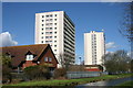
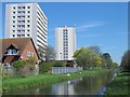
Living in EN1 4WJ offers a compact, residential experience with a population of 2,188, typical of a small postcode area. This cluster of homes is defined by its proximity to key transport links and local amenities, making it practical for daily life. The area’s demographic profile suggests a mature community, with a median age of 47 and a majority of residents aged 30–64. While the housing stock is predominantly flats, the area’s digital connectivity is robust, with near-perfect broadband scores and strong mobile coverage. This supports both remote work and everyday internet use. EN1 4WJ sits at the edge of practical reach for nearby retail, rail, and metro services, offering a balance between residential tranquillity and urban accessibility. The lack of environmental constraints, such as protected woodlands or wetlands, means development pressures are minimal. For buyers, this area represents a blend of affordability, convenience, and low environmental risk, though the moderate crime risk requires standard security measures.
- Area Type
- Postcode
- Area Size
- Not available
- Population
- 2188
- Population Density
- 13752 people/km²
EN1 4WJ’s property market is characterised by a high proportion of flats, with 33% of homes owned outright. This suggests a rental market with limited owner-occupied properties, possibly due to the area’s small size and focus on multi-unit housing. The dominance of flats may appeal to buyers seeking affordability or investors targeting the rental sector. However, the low home ownership rate indicates that many residents are tenants, which could affect the resale value of properties. The area’s compact nature means buyers should consider proximity to transport and amenities, as the immediate surroundings are likely to dictate property desirability. For those prioritising ownership, the market may present challenges, but the lack of environmental constraints and strong digital connectivity could offset these.
House Prices in EN1 4WJ
No properties found in this postcode.
Energy Efficiency in EN1 4WJ
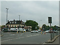
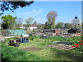
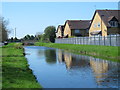
Residents of EN1 4WJ have access to a range of local amenities, including five retail outlets such as Aldi Southbury, Co-op Hertford, and Sainsburys Enfield. These stores provide everyday essentials, supporting a practical lifestyle. The area’s proximity to rail and metro stations—Turkey Street, Southbury, and Cockfosters—ensures easy access to broader urban services. While parks and leisure facilities are not explicitly listed, the absence of environmental constraints like protected woodlands or wetlands suggests space for informal recreation. The combination of retail options and transport links creates a self-contained environment, ideal for those prioritising convenience over expansive green spaces. This mix of accessibility and local services fosters a functional, community-focused daily life.
Amenities
Schools
| Rank | School | Type | Entry gender | Ages |
|---|
Explore more schools in this area
Go to Schools tabDemographics
EN1 4WJ’s population skews towards adults aged 30–64, with a median age of 47. This suggests a community of established professionals and families, though home ownership is relatively low at 33%. The majority of properties are flats, reflecting a rental-oriented market. The predominant ethnic group is White, with no specific data on other demographics. The age profile indicates a stable, middle-aged population, which may influence local services and social dynamics. With 33% of homes owned outright, the area is more likely to attract renters than buyers seeking long-term investment. The absence of detailed diversity metrics means the community’s cultural composition remains less defined. For residents, this profile implies a focus on practical living over luxury, with amenities tailored to adult needs rather than younger or older demographics.
Household Size
Accommodation Type
Tenure
Ethnic Group
Religion
Household Composition
Age
Household Deprivation
NS-SEC
Explore more demographic insights in this area
Go to Demographics tabPlanning
Planning Constraints
- Flood RiskPremium
- Ramsar Wetland SitesPremium
- Area of Outstanding Natural BeautyPremium
- Protected Nature ReservePremium
- Protected WoodlandPremium