Area Overview for EN1 4EZ
Photos of EN1 4EZ
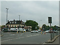
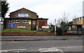
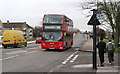
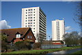
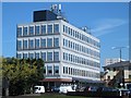
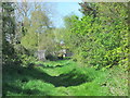
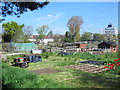
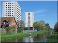
38 photos from this area
Area Information
Key information about the EN1 4EZ including its size, population, and administrative classification.
- Area Type
- Postcode
- Area Size
- 8264 m²
- Population
- 1770
- Population Density
- 8123 people/km²
House Prices in EN1 4EZ
30
Properties
£236,137
Average Sold Price
£88,750
Lowest Price
£445,000
Highest Price
Showing 30 properties
| Address | Type | Beds | Baths | Last Sale Price | Last Sale Date | |
|---|---|---|---|---|---|---|
| 121 Pembroke Avenue, Enfield, EN1 4EZ | Terraced | 2 | 1 | £445,000 | Jun 2023 | |
| 93 Pembroke Avenue, Enfield, EN1 4EZ | house | 3 | 1 | £375,000 | Dec 2020 | |
| 119 Pembroke Avenue, Enfield, EN1 4EZ | Terraced | 3 | 1 | £399,995 | Jun 2020 | |
| 105 Pembroke Avenue, Enfield, EN1 4EZ | Terraced | 3 | 1 | £330,000 | Nov 2019 | |
| 91 Pembroke Avenue, Enfield, EN1 4EZ | Terraced | 2 | 1 | £390,000 | Nov 2018 | |
| 111 Pembroke Avenue, Enfield, EN1 4EZ | house | 3 | 1 | £270,000 | Dec 2014 | |
| 97 Pembroke Avenue, Enfield, EN1 4EZ | Terraced | 3 | - | £250,000 | Jun 2013 | |
| 95 Pembroke Avenue, Enfield, EN1 4EZ | house | - | - | £247,000 | Apr 2008 | |
| 85 Pembroke Avenue, Enfield, EN1 4EZ | Terraced | 3 | 1 | £191,000 | Nov 2006 | |
| 131 Pembroke Avenue, Enfield, EN1 4EZ | Terraced | 3 | 1 | £195,000 | Oct 2006 |
Page 1 of 3
Energy Efficiency in EN1 4EZ
Amenities
Schools
| Rank | School | Type | Entry gender | Ages |
|---|
Explore more schools in this area
Go to Schools tabDemographics
Household Size
Family (3-5 people)
most common
Accommodation Type
Houses
most common
Tenure
48
majority
Ethnic Group
White
most common
Religion
N/A
most common
Household Composition
N/A
most common
Age
47
median
Adults (30-64 years)
most common
Household Deprivation
N/A
with no deprivation
NS-SEC
21
in Lower managerial occupations
Explore more demographic insights in this area
Go to Demographics tabPlanning
Planning Constraints
- Flood RiskPremium
- Ramsar Wetland SitesPremium
- Area of Outstanding Natural BeautyPremium
- Protected Nature ReservePremium
- Protected WoodlandPremium