Area Overview for EN1 3UX
Photos of EN1 3UX
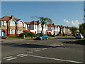
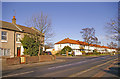
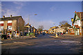
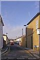
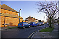
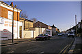
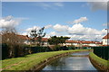
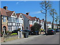
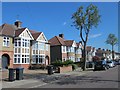
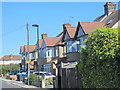
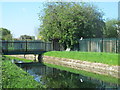
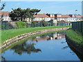
100 photos from this area
Area Information
Key information about the EN1 3UX including its size, population, and administrative classification.
- Area Type
- Postcode
- Area Size
- 7134 m²
- Population
- 1566
- Population Density
- 8497 people/km²
House Prices in EN1 3UX
27
Properties
£314,941
Average Sold Price
£130,995
Lowest Price
£595,000
Highest Price
Showing 27 properties
| Address | Type | Beds | Baths | Last Sale Price | Last Sale Date | |
|---|---|---|---|---|---|---|
| 8A Graeme Road, Enfield, EN1 3UX | Flat | - | - | £335,000 | Apr 2021 | |
| 30 Graeme Road, Enfield, EN1 3UX | Semi-detached | 3 | 2 | £545,000 | Dec 2019 | |
| 18 Graeme Road, Enfield, EN1 3UX | Terraced | 3 | 1 | £507,000 | Jul 2017 | |
| 6A Graeme Road, Enfield, EN1 3UX | Flat | 2 | 1 | £325,000 | Jan 2017 | |
| 6 Graeme Road, Enfield, EN1 3UX | Flat | - | - | £388,000 | Aug 2016 | |
| 36 Graeme Road, Enfield, EN1 3UX | house | 4 | - | £595,000 | Apr 2016 | |
| 24 Graeme Road, Enfield, EN1 3UX | Semi-detached | - | - | £353,000 | May 2012 | |
| 34 Graeme Road, Enfield, EN1 3UX | Semi-detached | - | - | £322,500 | Feb 2009 | |
| 8 Graeme Road, Enfield, EN1 3UX | Flat | - | - | £180,000 | Jan 2008 | |
| 46 Graeme Road, Enfield, EN1 3UX | Detached | - | - | £400,000 | Jun 2007 |
Page 1 of 3
Energy Efficiency in EN1 3UX
Amenities
Schools
| Rank | School | Type | Entry gender | Ages |
|---|
Explore more schools in this area
Go to Schools tabDemographics
Household Size
Family (3-5 people)
most common
Accommodation Type
Flats
most common
Tenure
52
majority
Ethnic Group
White
most common
Religion
N/A
most common
Household Composition
N/A
most common
Age
47
median
Adults (30-64 years)
most common
Household Deprivation
N/A
with no deprivation
NS-SEC
37
in Lower managerial occupations
Explore more demographic insights in this area
Go to Demographics tabPlanning
Planning Constraints
- Flood RiskPremium
- Ramsar Wetland SitesPremium
- Area of Outstanding Natural BeautyPremium
- Protected Nature ReservePremium
- Protected WoodlandPremium