Area Overview for EN1 3UA
Photos of EN1 3UA

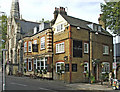
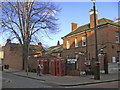
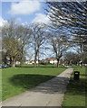
100 photos from this area
Area Information
Key information about the EN1 3UA including its size, population, and administrative classification.
- Area Type
- Postcode
- Area Size
- 9459 m²
- Population
- Not available
- Population Density
- Not available
House Prices in EN1 3UA
31
Properties
£377,932
Average Sold Price
£100,000
Lowest Price
£880,000
Highest Price
Showing 31 properties
| Address | Type | Beds | Baths | Last Sale Price | Last Sale Date | |
|---|---|---|---|---|---|---|
| 19 St Andrews Road, Enfield, EN1 3UA | Semi-detached | 5 | 3 | £880,000 | May 2022 | |
| 41 St Andrews Road, Enfield, EN1 3UA | Maisonette | - | - | £375,000 | May 2021 | |
| 25 St Andrews Road, Enfield, EN1 3UA | Flat | - | - | £430,000 | Aug 2020 | |
| 23 St Andrews Road, Enfield, EN1 3UA | Semi-detached | 5 | 2 | £822,000 | Jun 2018 | |
| 35 St Andrews Road, Enfield, EN1 3UA | house | 4 | 1 | £460,000 | Apr 2010 | |
| 31A St Andrews Road, Enfield, EN1 3UA | Flat | 2 | 1 | £198,500 | Jul 2009 | |
| 7 St Andrews Road, Enfield, EN1 3UA | Semi-detached | 6 | 2 | £465,000 | Dec 2005 | |
| 3 St Andrews Road, Enfield, EN1 3UA | Semi-detached | 5 | 4 | £100,000 | Jun 2001 | |
| 43 St Andrews Road, Enfield, EN1 3UA | Maisonette | - | - | £137,500 | Feb 2001 | |
| 33 St Andrews Road, Enfield, EN1 3UA | Terraced | - | - | £131,000 | Oct 1996 |
Page 1 of 4
Energy Efficiency in EN1 3UA
Amenities
Schools
| Rank | School | Type | Entry gender | Ages |
|---|
Explore more schools in this area
Go to Schools tabDemographics
Household Size
Two person
most common
Accommodation Type
Houses
most common
Tenure
57
majority
Ethnic Group
White
most common
Religion
N/A
most common
Household Composition
N/A
most common
Age
47
median
Adults (30-64 years)
most common
Household Deprivation
N/A
with no deprivation
NS-SEC
43
in Lower managerial occupations
Explore more demographic insights in this area
Go to Demographics tabPlanning
Planning Constraints
- Flood RiskPremium
- Ramsar Wetland SitesPremium
- Area of Outstanding Natural BeautyPremium
- Protected Nature ReservePremium
- Protected WoodlandPremium