Area Overview for EN1 3TW
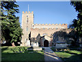
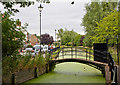
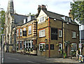
Photos of EN1 3TW


Area Information
Living in EN1 3TW means being part of a small, tightly knit residential cluster in England, home to 1,695 people. This area is characterised by its modest scale and proximity to essential services, making it practical for those seeking a balance between convenience and quiet living. The community is predominantly composed of adults aged 30–64, with a median age of 47, suggesting a mature, established population. Most residents own their homes, reflecting a stable, long-term presence in the area. EN1 3TW’s appeal lies in its accessibility: multiple rail and metro stations, including Enfield Town and Cockfosters, provide swift links to London’s transport network. While the area has no natural constraints like protected woodlands or wetlands, it does sit near practical amenities such as Iceland and M&S, ensuring daily needs are met. However, crime rates are average, requiring standard security measures. For buyers, EN1 3TW offers a compact, functional living environment with a focus on connectivity and community.
- Area Type
- Postcode
- Area Size
- Not available
- Population
- 1695
- Population Density
- 5590 people/km²
EN1 3TW is a predominantly owner-occupied area, with 81% of residents living in homes they own. This high rate of home ownership suggests a stable market where long-term residency is common. The accommodation type is largely houses, which contrasts with areas dominated by flats or apartments. This housing stock may appeal to buyers seeking traditional family homes or those prioritising space and private gardens. However, the area’s small size means the available properties are limited, and buyers may need to look beyond EN1 3TW itself for more options. The focus on owner-occupation also implies a lower rental market presence, which could be a consideration for those seeking investment opportunities or flexible living arrangements. For those looking to buy, the area’s compact nature and established housing stock offer a clear, if modest, selection of properties.
House Prices in EN1 3TW
No properties found in this postcode.
Energy Efficiency in EN1 3TW
Residents of EN1 3TW have access to a range of nearby amenities that support daily life. Retail options include Iceland Enfield, Waitrose Enfield, and M&S Enfield, offering everything from groceries to clothing. The area’s transport links are equally convenient, with rail stations like Enfield Town and Enfield Chase providing connections to London, while metro stops at Oakwood and Southgate add further accessibility. The Whipps Cross Bus Interchange serves as a hub for local routes. Though the area is small, these amenities ensure a balance between convenience and community. The presence of multiple retail and transport options means residents can meet their needs without traveling far, contributing to a practical, connected lifestyle.
Amenities
Schools
| Rank | School | Type | Entry gender | Ages |
|---|
Explore more schools in this area
Go to Schools tabDemographics
EN1 3TW’s population of 1,695 is predominantly made up of adults aged 30–64, with a median age of 47. This suggests a community of middle-aged residents, many of whom may be in their prime working years or nearing retirement. Home ownership is high, at 81%, indicating a strong presence of long-term residents who have invested in property. The accommodation type is primarily houses, which aligns with the area’s residential character and suggests a more traditional, family-oriented demographic. The predominant ethnic group is White, though no specific data on diversity or deprivation is provided. The absence of younger households or rental properties implies a stable, low-turnover environment. For those considering EN1 3TW, the demographic profile points to a mature, settled community with a focus on permanence and local connection.
Household Size
Accommodation Type
Tenure
Ethnic Group
Religion
Household Composition
Age
Household Deprivation
NS-SEC
Explore more demographic insights in this area
Go to Demographics tabPlanning
Planning Constraints
- Flood RiskPremium
- Ramsar Wetland SitesPremium
- Area of Outstanding Natural BeautyPremium
- Protected Nature ReservePremium
- Protected WoodlandPremium