Area Overview for EN1 1UB
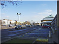
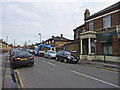
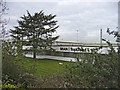
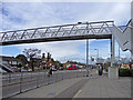
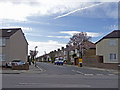
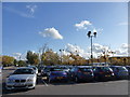
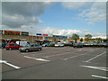
Photos of EN1 1UB

Area Information
Living in EN1 1UB means inhabiting a compact, residential postcode area in England, covering 2,703 square metres and home to 1,982 people. The population density is exceptionally high at 733,328 people per square kilometre, reflecting a tightly packed community. This small area is characterised by its proximity to essential services and transport links, making it convenient for daily life. Residents benefit from a mix of local amenities, including schools, retail outlets, and public transport hubs. The area’s compact nature means it is ideal for those seeking proximity to urban conveniences without the sprawl of larger suburbs. With a median age of 47 and a predominance of adults aged 30–64, the community is mature and stable, though the 39% home ownership rate suggests a significant rental market. EN1 1UB is not a sprawling suburb but a focused cluster of homes, where daily routines are shaped by the immediate surroundings. Its density and accessibility make it a practical choice for those prioritising convenience over expansive living spaces.
- Area Type
- Postcode
- Area Size
- 2703 m²
- Population
- 1982
- Population Density
- 2085 people/km²
EN1 1UB’s property market is defined by its high density and limited space. With 39% of homes owner-occupied, the area is not dominated by rental properties, though the small size of the postcode suggests a constrained housing stock. The accommodation type is primarily houses, which is notable given the area’s compact nature. This implies that homes are likely smaller or designed for single-family occupancy, possibly with shared or semi-detached structures. Buyers should consider that the area’s small size limits availability, and properties may be highly sought after due to proximity to amenities. The high population density may also mean that properties are closely spaced, which could influence desirability depending on personal preferences. For those seeking a house in a convenient location, EN1 1UB offers proximity to transport and services, but the market is likely competitive due to its limited scale.
House Prices in EN1 1UB
Showing 1 properties
| Address | Type | Beds | Baths | Last Sale Price | Last Sale Date | |
|---|---|---|---|---|---|---|
| 328 Southbury Road, Enfield, EN1 1UB | commercial | - | - | - | - |
Energy Efficiency in EN1 1UB
The lifestyle in EN1 1UB is shaped by its proximity to retail, transport, and public spaces. Residents have access to major supermarkets like Morrisons, Sainsburys, and Tesco, ensuring everyday shopping needs are met locally. The area’s rail and metro stations—such as Southbury, Ponders End, and Arnos Grove—provide easy access to wider London, while the Whipps Cross Bus Interchange connects to surrounding areas. Though the data does not specify parks or leisure facilities, the high population density suggests that public spaces may be limited. The presence of multiple schools and transport hubs indicates a focus on practicality over expansive recreational areas. For those prioritising convenience, EN1 1UB offers a compact, service-rich environment. However, the lack of detailed information on parks or cultural amenities means potential residents should investigate local green spaces or community facilities separately.
Amenities
Schools
EN1 1UB is served by a selection of primary schools, including Suffolks Primary School and Bishop Stopford’s School, both rated ‘good’ by Ofsted. Kingsmead School appears twice in the data: once as a primary school and once as an academy with a ‘good’ rating. This mix of school types offers families options, with academies often providing distinct educational approaches. The presence of multiple primary schools within reach suggests a focus on early education, which is critical for young families. However, the data does not mention secondary schools or further education institutions. For parents prioritising primary education, the ‘good’ Ofsted ratings indicate a baseline of quality, though the absence of specific performance metrics means further research into individual schools would be necessary. The clustering of schools in the area may also contribute to a sense of community among families.
| Rank | School | Type | Entry gender | Ages |
|---|
Explore more schools in this area
Go to Schools tabDemographics
EN1 1UB’s population skews towards adults aged 30–64, with a median age of 47. This suggests a community of established professionals and families, though the 39% home ownership rate indicates that nearly two-thirds of residents rent their homes. The area is predominantly White, and the accommodation type is primarily houses, which is unusual for a high-density postcode. The high population density—733,328 people per square kilometre—means living spaces are closely packed, potentially impacting privacy and outdoor space. While the data does not specify deprivation levels, the demographic profile implies a stable, working-age population. However, the absence of younger residents or retirees may affect local services and social dynamics. The area’s compact size and mature age profile create a distinct character, shaped by long-term residents and a focus on practical living over sprawling development.
Household Size
Accommodation Type
Tenure
Ethnic Group
Religion
Household Composition
Age
Household Deprivation
NS-SEC
Explore more demographic insights in this area
Go to Demographics tabPlanning
Planning Constraints
- Flood RiskPremium
- Ramsar Wetland SitesPremium
- Area of Outstanding Natural BeautyPremium
- Protected Nature ReservePremium
- Protected WoodlandPremium