Area Overview for EN1 1RG
Photos of EN1 1RG
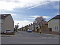
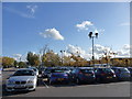
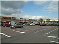
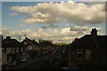
92 photos from this area
Area Information
Key information about the EN1 1RG including its size, population, and administrative classification.
- Area Type
- Postcode
- Area Size
- 6810 m²
- Population
- 1982
- Population Density
- 2085 people/km²
House Prices in EN1 1RG
19
Properties
£231,000
Average Sold Price
£100,000
Lowest Price
£535,000
Highest Price
Showing 19 properties
| Address | Type | Beds | Baths | Last Sale Price | Last Sale Date | |
|---|---|---|---|---|---|---|
| 273 Southbury Road, Enfield, EN1 1RG | Terraced | 3 | 1 | £535,000 | Sep 2023 | |
| 279 Southbury Road, Enfield, EN1 1RG | house | - | - | £196,000 | Jun 2020 | |
| 255 Southbury Road, Enfield, EN1 1RG | Terraced | 3 | 1 | £295,000 | Jun 2011 | |
| 271 Southbury Road, Enfield, EN1 1RG | Terraced | 3 | 1 | £218,000 | Apr 2007 | |
| 261 Southbury Road, Enfield, EN1 1RG | house | - | - | £204,000 | Jun 2005 | |
| 265 Southbury Road, Enfield, EN1 1RG | house | 4 | 1 | £160,000 | Feb 2003 | |
| 277 Southbury Road, Enfield, EN1 1RG | Terraced | - | - | £140,000 | Mar 2001 | |
| 269 Southbury Road, Enfield, EN1 1RG | Terraced | 3 | - | £100,000 | Jun 1998 | |
| 275 Southbury Road, Enfield, EN1 1RG | Terraced | 3 | - | - | - | |
| Flat Above Public House, 253 Southbury Road, Enfield, EN1 1RG | Flat | - | - | - | - |
Page 1 of 2
Energy Efficiency in EN1 1RG
Amenities
Schools
| Rank | School | Type | Entry gender | Ages |
|---|
Explore more schools in this area
Go to Schools tabDemographics
Household Size
Family (3-5 people)
most common
Accommodation Type
Houses
most common
Tenure
39
majority
Ethnic Group
White
most common
Religion
N/A
most common
Household Composition
N/A
most common
Age
47
median
Adults (30-64 years)
most common
Household Deprivation
N/A
with no deprivation
NS-SEC
22
in Lower managerial occupations
Explore more demographic insights in this area
Go to Demographics tabPlanning
Planning Constraints
- Flood RiskPremium
- Ramsar Wetland SitesPremium
- Area of Outstanding Natural BeautyPremium
- Protected Nature ReservePremium
- Protected WoodlandPremium