Area Overview for EC4M 9AD
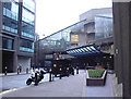
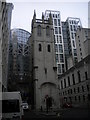
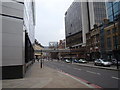
Photos of EC4M 9AD


Area Information
Living in EC4M 9AD means inhabiting a tightly packed residential cluster in central London, where 1,619 residents occupy just 8,692 square metres. This postcode is a microcosm of urban density, with a population density of 984 people per square kilometre. Its proximity to landmarks like St Paul’s Cathedral and the City of London’s financial heart makes it a hub for professionals and commuters. The area’s compact size means amenities are within easy reach, from retail outlets to transport hubs. While the median age of 47 suggests a mature demographic, the presence of outstanding-rated schools like The Aldgate School and David Game College indicates a focus on family life. Daily routines here are shaped by the need to navigate high-density living, but the area’s connectivity—via multiple metro, rail, and ferry options—offers flexibility. EC4M 9AD is not for those seeking space, but it rewards those who prioritise convenience, culture, and proximity to London’s pulse.
- Area Type
- Postcode
- Area Size
- 8692 m²
- Population
- 1619
- Population Density
- 984 people/km²
EC4M 9AD’s property market is characterised by a low home ownership rate of 25%, suggesting that the area is predominantly a rental market. The accommodation type is almost exclusively flats, which aligns with the postcode’s small size and high density. This means the housing stock is limited to smaller, often older units, with little scope for expansion or redevelopment. For buyers, this presents challenges: the area’s compact nature and lack of available properties may make it difficult to find a home for purchase. However, the proximity to transport links and schools could appeal to investors seeking short-term rental opportunities. The limited availability of owner-occupied properties also means that those looking to buy must compete in a niche market, where demand may outstrip supply.
House Prices in EC4M 9AD
No properties found in this postcode.
Energy Efficiency in EC4M 9AD
Residents of EC4M 9AD enjoy a wealth of amenities within walking distance. Retail options include Co-op London, M&S New Change, and Tesco Cheapside, offering everything from groceries to fashion. Transport hubs like St. Paul’s Station and Bank provide easy access to the City and beyond, while ferry piers at Blackfriars and London Bridge connect to Thames-side destinations. The area’s compact size means leisure and daily needs are tightly woven into its fabric. For example, the proximity to the Fashion Retail Academy hints at a focus on vocational training, while the density of transport links supports a fast-paced, commuter-friendly lifestyle. The mix of retail, transport, and education facilities creates a self-contained environment, though its small footprint may limit space for larger community gatherings.
Amenities
Schools
The schools near EC4M 9AD cater to a range of educational needs, from primary to independent institutions. The Aldgate School, an outstanding-rated primary, serves younger children, while St Paul’s Cathedral School and City of London School offer independent education for older students. David Game College, also outstanding-rated, provides further education options. The Fashion Retail Academy adds a vocational dimension. This mix ensures families have choices, whether seeking state-funded education or private schooling. The presence of multiple high-quality schools, particularly the two outstanding-rated institutions, makes the area attractive to parents prioritising academic standards. However, the concentration of independent schools may reflect a demographic skewed towards higher-income households.
| Rank | School | Type | Entry gender | Ages |
|---|---|---|---|---|
| 1 | The Aldgate School | primary | N/A | N/A |
| 2 | St Paul's Cathedral School | independent | N/A | N/A |
| 3 | City of London School | independent | N/A | N/A |
| 4 | David Game College | independent | N/A | N/A |
| 5 | Fashion Retail Academy | other | N/A | N/A |
Explore more schools in this area
Go to Schools tabDemographics
The community in EC4M 9AD is predominantly composed of adults aged 30–64, with a median age of 47. This suggests a population skewed towards professionals and families, though the 25% home ownership rate indicates that most residents are renters. The accommodation type is almost entirely flats, reflecting the area’s compact nature. The predominant ethnic group is White, though specific diversity metrics are not provided. The high population density of 984 people per square kilometre means shared spaces and communal living are the norm. While this fosters a tightly knit environment, it also raises questions about the balance between privacy and proximity. The age profile implies a stable, established community, but the low home ownership rate may indicate limited long-term investment in property. For residents, this translates to a lifestyle centred on convenience rather than permanence.
Household Size
Accommodation Type
Tenure
Ethnic Group
Religion
Household Composition
Age
Household Deprivation
NS-SEC
Explore more demographic insights in this area
Go to Demographics tabPlanning
Planning Constraints
- Flood RiskPremium
- Ramsar Wetland SitesPremium
- Area of Outstanding Natural BeautyPremium
- Protected Nature ReservePremium
- Protected WoodlandPremium
- Crime RiskPremium