Area Overview for EC3R 5HE
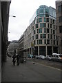
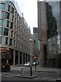
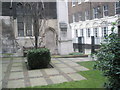
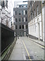
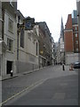
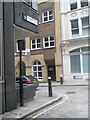
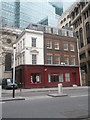
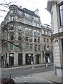
Photos of EC3R 5HE


Area Information
EC3R 5HE is a compact residential postcode in central London, nestled near historic landmarks such as the Tower of London and the City of London financial district. With a population of 1,619 and a density of 984 people per square kilometre, this area is characterised by its tight-knit community and proximity to major urban hubs. Daily life here is defined by convenience, with easy access to transport networks, retail centres, and cultural institutions. The postcode covers a small cluster of properties, many of which are flats, reflecting the area’s high density. Residents benefit from being within walking distance of iconic sites like St Paul’s Cathedral and the Tower of London, while the surrounding streets offer a blend of historic architecture and modern infrastructure. The area’s appeal lies in its strategic location, bridging residential comfort with the vibrancy of London’s financial and cultural heart. For those seeking a balance between urban energy and manageable living space, EC3R 5HE offers a unique position in one of the city’s most dynamic zones.
- Area Type
- Postcode
- Area Size
- Not available
- Population
- 1619
- Population Density
- 984 people/km²
The property market in EC3R 5HE is dominated by flats, with only 25% of homes owned by residents. This indicates a rental market that caters to professionals and commuters requiring short-term or flexible housing solutions. The high population density and limited availability of owner-occupied properties suggest that the area is more suited to renters than buyers looking for long-term investment. The small size of the postcode means that property options are limited, with most homes being flats in multi-unit buildings. For buyers, this presents challenges, as the area is unlikely to offer a wide range of owner-occupied properties. However, the proximity to major transport links and amenities may make it an attractive option for those prioritising location over property type. The market is likely to be competitive, with limited supply and high demand from those seeking central London living.
House Prices in EC3R 5HE
No properties found in this postcode.
Energy Efficiency in EC3R 5HE
Living in EC3R 5HE offers access to a variety of amenities within easy reach. Retail options include major stores such as Tesco Monument, Waitrose Little, and M&S Fenchurch St Rail SF, catering to everyday shopping needs. The area’s proximity to the Thames and nearby piers like Tower Pier and London Bridge City Pier provides opportunities for leisure activities, including boat trips and waterfront dining. Transport hubs such as Liverpool Street Station and London Bridge Station make commuting straightforward, while nearby metro stations like Tower Hill offer quick access to cultural landmarks. For those requiring travel beyond London, Victoria Coach Station and London City Airport are within practical reach. The mix of retail, transport, and leisure options ensures that residents have access to both convenience and urban vibrancy. The area’s compact size means that amenities are closely clustered, reducing the need for long journeys to access services.
Amenities
Schools
Residents of EC3R 5HE have access to a range of educational institutions, including The Aldgate School, a primary school with an outstanding Ofsted rating, and David Game College, an independent school also rated outstanding. Nearby independent schools such as St Paul’s Cathedral School and City of London School cater to older students, offering alternative educational pathways. The presence of both state and independent schools provides families with options to suit their preferences and budgets. The Aldgate School’s high rating ensures quality primary education, while the independent schools offer prestige and resources. For those seeking vocational training, the Fashion Retail Academy is also nearby. This mix of school types reflects the area’s diversity, offering both affordable and high-end educational opportunities. Families moving to EC3R 5HE can select from a range of institutions to meet their children’s needs.
| Rank | School | Type | Entry gender | Ages |
|---|
Explore more schools in this area
Go to Schools tabDemographics
The population of EC3R 5HE has a median age of 47, with the majority of residents falling within the 30–64 age range. This suggests a mature, established community, likely composed of professionals and families seeking stability in a central location. Home ownership is relatively low at 25%, indicating that most residents are likely to be renters, possibly due to the area’s high property prices and limited availability of owner-occupied homes. The predominant accommodation type is flats, reflecting the area’s density and the typical housing stock in central London. The predominant ethnic group is White, though specific data on diversity is not provided. The age profile and ownership figures suggest a community that prioritises convenience and proximity to services over long-term property investment. For buyers, this means the area is more likely to cater to those seeking rental properties or short-term housing rather than owner-occupied homes.
Household Size
Accommodation Type
Tenure
Ethnic Group
Religion
Household Composition
Age
Household Deprivation
NS-SEC
Explore more demographic insights in this area
Go to Demographics tabPlanning
Planning Constraints
- Flood RiskPremium
- Ramsar Wetland SitesPremium
- Area of Outstanding Natural BeautyPremium
- Protected Nature ReservePremium
- Protected WoodlandPremium