Area Overview for EC3A 7JS
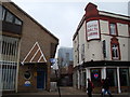
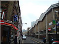
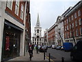
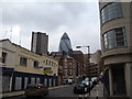
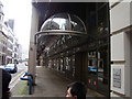
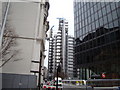
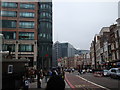
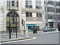
Photos of EC3A 7JS


Area Information
EC3A 7JS is a compact postcode area in central London, home to 1,619 residents in a densely populated cluster of 984 people per square kilometre. This small residential zone sits within the City of London, a historic and commercial hub, offering proximity to landmarks like St Paul’s Cathedral and the Thames. Daily life here is shaped by its urban context, with a mix of professional and semi-retired residents. The area’s character is defined by its proximity to financial institutions, transport networks, and cultural sites. While it lacks green spaces, its location provides easy access to the city’s amenities, from retail to dining. The high population density means living here feels dynamic, with a constant flow of people and activity. For those seeking a central location with minimal commute times, EC3A 7JS offers strategic positioning near major rail and metro lines, though the compact size means every resident shares a tightly woven community.
- Area Type
- Postcode
- Area Size
- Not available
- Population
- 1619
- Population Density
- 984 people/km²
The property market in EC3A 7JS is dominated by flats, with only 25% of homes owned by residents. This suggests a rental-heavy market, where the majority of housing is occupied by tenants rather than homeowners. The compact nature of the area means that property availability is limited, and the high population density contributes to competitive demand. Flats in this postcode are likely to be smaller, reflecting the constraints of the urban environment. For buyers, this area may present challenges due to the limited number of owner-occupied properties and the potential for high rental yields. However, the proximity to central London’s amenities, including transport links and employment opportunities, could make it an attractive option for investors. The small size of the area means that buyers must consider nearby postcode clusters for more housing options, though these may come with higher prices or longer commute times.
House Prices in EC3A 7JS
No properties found in this postcode.
Energy Efficiency in EC3A 7JS
Living in EC3A 7JS grants access to a range of amenities, from retail to transport hubs. Nearby shops include M&S Bishopsgate, Tesco St., and Co-op Fenchurch, offering everyday essentials. The area’s proximity to Liverpool Street Station and London City Airport makes it ideal for frequent travellers. Public transport options are extensive, with metro stops like Tower Hill and Monument providing quick links to central London. Ferry services from Tower Pier and London Bridge City Pier add flexibility for commuting or leisure. While the area lacks large parks, its urban setting means residents can access cultural sites like St Paul’s Cathedral and the City of London’s financial district. The presence of multiple retail outlets and transport links ensures convenience for daily life, though the small size of the postcode means that more extensive leisure options may require a short journey.
Amenities
Schools
EC3A 7JS is served by a range of schools, including The Aldgate School, which is a primary school with an Ofsted rating of outstanding. This indicates a high standard of education for younger children in the area. St Paul’s Cathedral School and City of London School are both independent institutions, offering fee-paying options for families seeking private education. David Game College, another independent school, also holds an outstanding Ofsted rating, suggesting excellence in its academic programmes. The Fashion Retail Academy is listed as an ‘other’ type of institution, though its specific focus is not detailed. The mix of state and independent schools provides families with choices, from high-quality public education to private alternatives. However, the availability of secondary schools is not explicitly mentioned, so parents may need to look beyond the immediate area for comprehensive schooling.
| Rank | School | Type | Entry gender | Ages |
|---|
Explore more schools in this area
Go to Schools tabDemographics
The population of EC3A 7JS has a median age of 47, with the majority of residents falling between 30 and 64 years old. This suggests a community skewed toward working-age adults, many of whom may be employed in the nearby financial sector. Home ownership in the area is relatively low at 25%, indicating that a significant portion of the housing stock is rented. The predominant accommodation type is flats, reflecting the area’s density and limited space for larger properties. The predominant ethnic group is White, though specific data on diversity beyond this is not provided. The age profile and ownership statistics suggest a population that may include professionals working in the City, as well as those in semi-retirement. The lack of higher deprivation indicators is not explicitly stated, but the low home ownership rate could imply a reliance on rental markets, which may affect long-term stability for some residents.
Household Size
Accommodation Type
Tenure
Ethnic Group
Religion
Household Composition
Age
Household Deprivation
NS-SEC
Explore more demographic insights in this area
Go to Demographics tabPlanning
Planning Constraints
- Flood RiskPremium
- Ramsar Wetland SitesPremium
- Area of Outstanding Natural BeautyPremium
- Protected Nature ReservePremium
- Protected WoodlandPremium