Area Overview for EC3A 5AN
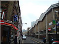
Photos of EC3A 5AN


Area Information
EC3A 5AN is a compact postcode area in central London, home to 1,619 residents living at a density of 984 people per square kilometre. This small residential cluster lies at the heart of the City of London, offering a blend of urban convenience and proximity to major landmarks. The area is defined by its high population density, which reflects its role as a hub for professionals and commuters. Despite its size, EC3A 5AN is rich in connectivity, with multiple rail, metro, and ferry options within walking distance. Daily life here is shaped by its location—residents enjoy swift access to financial districts, cultural sites, and transport networks. The area’s character is influenced by its mix of historic and modern infrastructure, though its small footprint means it is tightly integrated with surrounding neighbourhoods. For those seeking a central London address with strong transport links, EC3A 5AN offers a compact, efficient living environment. However, its density also means it is a highly competitive market, with limited space for expansion or new development.
- Area Type
- Postcode
- Area Size
- Not available
- Population
- 1619
- Population Density
- 984 people/km²
EC3A 5AN is a rental-dominated area, with only 25% of residents owning their homes. The accommodation type is predominantly flats, which aligns with the high population density and compact nature of the postcode. This suggests a housing stock that is likely older, with limited scope for major redevelopment. The small area means property options are limited, and buyers should consider the surrounding neighbourhoods for more variety. The high demand for rental properties may drive up prices, though the market remains niche due to the area’s size. For those seeking owner-occupied homes, EC3A 5AN may not be the most viable option, as the majority of properties are let out to tenants. Investors might find opportunities in the flat market, but buyers should be prepared for a competitive environment with few new developments.
House Prices in EC3A 5AN
No properties found in this postcode.
Energy Efficiency in EC3A 5AN
Living in EC3A 5AN offers access to a range of amenities within easy reach. Retail options include Co-op Fenchurch, Tesco St., and M&S Fenchurch St Rail SF, catering to daily needs. The area’s transport network—rail, metro, ferry, and bus—ensures seamless travel to nearby districts. Proximity to London City Airport adds convenience for frequent travellers. While the data does not specify parks or leisure facilities, the density of amenities suggests a focus on urban convenience over green spaces. Residents can enjoy the vibrancy of central London, with easy access to cultural and commercial hubs. The mix of retail, transport, and nearby schools creates a functional, fast-paced lifestyle. However, the compact nature of the area means leisure options may be limited compared to larger neighbourhoods.
Amenities
Schools
EC3A 5AN is served by a range of schools, including The Aldgate School, a primary school with an outstanding Ofsted rating, and St Paul’s Cathedral School, an independent institution. Nearby, City of London School and David Game College are also independent, offering high-quality education for older students. The Fashion Retail Academy, an other-type institution, provides vocational training. The mix of state and independent schools offers families flexibility, with the outstanding-rated primary school a notable asset. However, the absence of secondary state schools may require parents to consider commuting to nearby areas. For those prioritising academic excellence, the independent schools in the vicinity provide strong alternatives. The presence of multiple educational institutions reflects the area’s role as a hub for professionals and families seeking quality schooling.
| Rank | School | Type | Entry gender | Ages |
|---|
Explore more schools in this area
Go to Schools tabDemographics
The population of EC3A 5AN is predominantly adults aged 30–64, with a median age of 47. This suggests a mature, established community with a focus on professional or semi-retired individuals. Only 25% of residents own their homes, indicating that the area is largely a rental market. The primary accommodation type is flats, reflecting the urban nature of the postcode. The predominant ethnic group is White, though specific data on diversity or deprivation is not provided. The high population density—984 people per square kilometre—means housing is tightly packed, which may impact living space and privacy. The age profile suggests a stable demographic, with fewer young families or elderly residents. For those considering EC3A 5AN, the limited home ownership rate and flat-based housing stock imply a focus on short-term or investment properties rather than long-term family homes.
Household Size
Accommodation Type
Tenure
Ethnic Group
Religion
Household Composition
Age
Household Deprivation
NS-SEC
Explore more demographic insights in this area
Go to Demographics tabPlanning
Planning Constraints
- Flood RiskPremium
- Ramsar Wetland SitesPremium
- Area of Outstanding Natural BeautyPremium
- Protected Nature ReservePremium
- Protected WoodlandPremium