Area Overview for EC2N 4AY
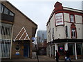
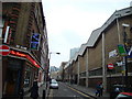
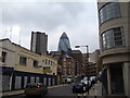
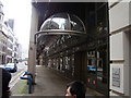
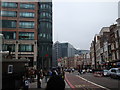
Photos of EC2N 4AY


Area Information
EC2N 4AY is a compact residential postcode in central London, covering 8,626 square metres and home to 1,619 residents. Its high population density of 984 people per square kilometre reflects its role as a tightly knit urban enclave. This area is defined by its proximity to key transport hubs and historic landmarks, making it a practical choice for those prioritising connectivity. Daily life here is shaped by the surrounding infrastructure, with residents frequently navigating the nearby rail, metro, and ferry networks. The area’s small size means it is best suited for those seeking convenience over expansive living spaces. While it lacks green spaces, its strategic location ensures access to cultural and commercial amenities within walking distance. The community is predominantly composed of adults aged 30-64, suggesting a mature demographic with established routines. Living in EC2N 4AY offers a blend of urban efficiency and proximity to London’s core, though its density may appeal more to commuters and professionals than to families seeking larger homes.
- Area Type
- Postcode
- Area Size
- 8626 m²
- Population
- 1619
- Population Density
- 984 people/km²
The property market in EC2N 4AY is characterised by a low home ownership rate of 25%, suggesting that the area is primarily a rental market. The accommodation type is almost exclusively flats, which aligns with the area’s high population density and compact footprint. This makes EC2N 4AY unsuitable for buyers seeking larger, owner-occupied homes, as the housing stock is limited to smaller, multi-unit properties. The small size of the area means that property availability is constrained, and competition for rentals may be fierce, particularly near transport links and amenities. Buyers should consider that the market is likely dominated by short-term tenancies, with limited scope for long-term investment. The absence of data on property prices or trends means that prospective buyers must rely on local agents for up-to-date valuations. For those prioritising proximity to central London’s infrastructure, EC2N 4AY offers convenience, but its limited housing options may not cater to all buyer needs.
House Prices in EC2N 4AY
Showing 2 properties
| Address | Type | Beds | Baths | Last Sale Price | Last Sale Date | |
|---|---|---|---|---|---|---|
| Duck & Waffle, 40TH Floor Retail Unit, 110 Bishopsgate, London, EC2N 4AY | Restaurant | - | - | - | - | |
| The Drift, 70 Houndsditch, London, EC2N 4AY | Retail | - | - | - | - |
Energy Efficiency in EC2N 4AY
Residents of EC2N 4AY enjoy proximity to a variety of retail, transport, and leisure amenities. The area is within walking distance of major retailers such as Tesco Bishopsgate and M&S Bishopsgate, offering everyday shopping convenience. Transport hubs like Liverpool Street Station and nearby metro stops provide seamless access to the city’s business and cultural centres. Ferry services at Tower Pier and London Bridge City Pier add to the area’s connectivity, while nearby bus routes link to destinations such as Victoria Coach Station. The presence of London City Airport within reach further enhances the area’s appeal for those with international travel needs. However, the absence of parks or recreational spaces means that residents must venture beyond the immediate area for green spaces or leisure activities. The lifestyle in EC2N 4AY is defined by efficiency and accessibility, with amenities clustered around transport corridors. This makes it ideal for those prioritising convenience over expansive living environments, though it may lack the communal or recreational elements found in more suburban settings.
Amenities
Schools
Residents of EC2N 4AY have access to a range of educational institutions, including The Aldgate School, an outstanding-rated primary school, and David Game College, an independent institution also rated outstanding. Independent schools such as St Paul’s Cathedral School and City of London School cater to those seeking private education, while the Fashion Retail Academy offers vocational training. The mix of school types provides options for both state and private education, though the absence of secondary schools in the immediate area may require families to consider nearby districts for comprehensive schooling. The presence of high-rated institutions like The Aldgate School and David Game College suggests that the area is attractive to families prioritising quality education. However, the lack of detailed data on school catchment areas or student performance means that prospective residents should verify admissions criteria independently.
| Rank | School | Type | Entry gender | Ages |
|---|
Explore more schools in this area
Go to Schools tabDemographics
The population of EC2N 4AY has a median age of 47, with the majority of residents falling within the 30-64 age range. This suggests a community of working-age adults, many of whom may be employed in nearby financial or professional sectors. Home ownership is relatively low at 25%, indicating that a significant portion of the housing stock is rented. The accommodation type is predominantly flats, reflecting the area’s high density and limited space for larger properties. The predominant ethnic group is White, though no specific data on diversity or deprivation levels is provided. The absence of detailed diversity statistics means the community’s composition remains largely undefined in terms of cultural mix. For those considering EC2N 4AY, the demographic profile points to a mature, possibly transient population, with housing options skewed towards rental properties. This may influence the area’s social dynamics, with a focus on temporary or professional housing rather than long-term family homes.
Household Size
Accommodation Type
Tenure
Ethnic Group
Religion
Household Composition
Age
Household Deprivation
NS-SEC
Explore more demographic insights in this area
Go to Demographics tabPlanning
Planning Constraints
- Flood RiskPremium
- Ramsar Wetland SitesPremium
- Area of Outstanding Natural BeautyPremium
- Protected Nature ReservePremium
- Protected WoodlandPremium