Area Overview for EC2N 4AH
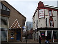
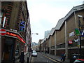
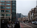
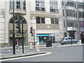
Photos of EC2N 4AH


Area Information
EC2N 4AH is a compact residential postcode in central London, covering 302 square metres and home to 1,619 residents. Its high population density of 984 people per square kilometre reflects its role as a tightly knit urban area, likely situated near commercial or transport hubs. Living here means proximity to London’s cultural and economic heart, with easy access to major infrastructure. The area’s small size suggests a focused, perhaps historic layout, typical of central London’s postcode clusters. Residents benefit from being close to key amenities, though the density may mean limited private outdoor space. The mix of housing types, predominantly flats, indicates a mix of long-term residents and those in rental properties. This area suits professionals or commuters seeking convenience, though the compact nature may appeal more to those prioritising location over space.
- Area Type
- Postcode
- Area Size
- 302 m²
- Population
- 1619
- Population Density
- 984 people/km²
EC2N 4AH’s property market is characterised by a low home ownership rate of 25%, suggesting it is primarily a rental area. The accommodation type is predominantly flats, which aligns with central London’s housing trends. This small postcode likely contains a limited number of properties, many of which may be part of larger residential blocks or developments. For buyers, this area may present challenges, as the low ownership rate indicates limited availability of owner-occupied homes. The compact size of the postcode means the housing stock is concentrated, potentially leading to competition for available properties. Renters may find a range of flats, but buyers seeking long-term ownership might need to consider nearby areas for more options. The market here is likely influenced by proximity to transport and employment hubs, making it attractive to professionals or commuters.
House Prices in EC2N 4AH
No properties found in this postcode.
Energy Efficiency in EC2N 4AH
Residents of EC2N 4AH enjoy a range of amenities within walking distance, including major retailers like M&S Bishopsgate, Tesco Broadgate Old, and Sainsburys London. The area’s proximity to transport hubs such as Liverpool Street Station and London City Airport enhances convenience for both commuters and travellers. Ferry access to Tower Pier and Tower Bridge Quay adds to the area’s connectivity. The presence of multiple bus stops, including Green Line Coach Station and Victoria Coach Station, ensures flexibility in travel. While the data does not specify parks or leisure facilities, the density of retail and transport options suggests a lifestyle focused on efficiency and accessibility. The mix of shops, dining, and transport links caters to daily needs, making the area suitable for those prioritising convenience over expansive recreational spaces.
Amenities
Schools
Residents of EC2N 4AH have access to a range of educational institutions, including The Aldgate School, a primary school with an outstanding Ofsted rating, and David Game College, an independent institution also rated outstanding. Independent schools such as St Paul’s Cathedral School and City of London School cater to families seeking private education. The presence of both state and independent options provides flexibility for parents, though the independent schools may have higher fees. The Fashion Retail Academy, listed as an “other” category, suggests vocational or specialist training opportunities. The mix of school types indicates a diverse educational landscape, from early years to further education. Families with children may find the area appealing for its proximity to high-quality schools, though the limited number of institutions may require careful planning for catchment areas.
| Rank | School | Type | Entry gender | Ages |
|---|
Explore more schools in this area
Go to Schools tabDemographics
The population of EC2N 4AH is predominantly adults aged 30–64, with a median age of 47. This suggests a mature, established community, possibly with a mix of professionals and families. Home ownership is low at 25%, indicating that most residents are renters, which is common in central London. The area’s accommodation is largely flats, reflecting the city’s typical housing stock in high-density zones. The predominant ethnic group is White, though the data does not specify further diversity metrics. With a population density of 984 people per square kilometre, daily life likely involves shared spaces and a reliance on nearby amenities. The age profile implies a community with a balance of career-focused individuals and those in later life stages, potentially influencing local services and social dynamics.
Household Size
Accommodation Type
Tenure
Ethnic Group
Religion
Household Composition
Age
Household Deprivation
NS-SEC
Explore more demographic insights in this area
Go to Demographics tabPlanning
Planning Constraints
- Flood RiskPremium
- Ramsar Wetland SitesPremium
- Area of Outstanding Natural BeautyPremium
- Protected Nature ReservePremium
- Protected WoodlandPremium