Area Overview for EC2A 4LR
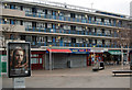
Photos of EC2A 4LR


Area Information
EC2A 4LR is a compact residential postcode in central London, spanning just 1,496 square metres and home to 2,356 residents. Its high population density—1.57 million people per square kilometre—reflects its role as a tightly packed urban enclave. The area is defined by its proximity to key transport hubs, retail centres, and educational institutions, making it a hub for commuters and professionals. Daily life here is shaped by its location: within walking distance of Old Street and Moorgate stations, and near London City Airport. Residents benefit from excellent digital connectivity, with a broadband score of 98, ideal for remote work. However, the area’s small size means it is more of a transitional space than a standalone community, with most amenities and services located just beyond its boundaries. Despite its density, EC2A 4LR offers a mix of practicality and convenience, though its high crime risk and lack of green spaces may concern some buyers.
- Area Type
- Postcode
- Area Size
- 1496 m²
- Population
- Not available
- Population Density
- Not available
EC2A 4LR is not a typical owner-occupied area. With only 22% of residents owning their homes, the market is heavily skewed toward rental properties. The accommodation type is almost exclusively flats, which aligns with the area’s small size and urban character. This makes it an attractive option for renters seeking short-term or flexible housing, particularly those working in nearby business districts. However, the limited availability of owner-occupied properties means buyers may struggle to find homes for purchase. The area’s compact nature also restricts the diversity of housing stock, with few larger properties or family homes. For those considering buying, the focus should be on nearby areas with more varied options, though EC2A 4LR’s proximity to transport and amenities could justify its appeal as a secondary residence.
House Prices in EC2A 4LR
No properties found in this postcode.
Energy Efficiency in EC2A 4LR
Life in EC2A 4LR is defined by its proximity to retail, transport, and travel hubs. Nearby shops include Sainsburys London, Tesco City, and Sainsburys Shoreditch, offering convenience for daily errands. The area’s rail, metro, and ferry connections provide seamless access to London’s business districts and cultural centres. For commuters, stations like Shoreditch High Street and Bank offer links to the City and beyond, while London City Airport is a short journey away. The presence of multiple bus stops, including Victoria Coach Station, adds to the area’s connectivity. However, the lack of parks or leisure facilities means residents must venture beyond EC2A 4LR for recreational activities. The lifestyle here is practical and fast-paced, ideal for those prioritising accessibility over green spaces.
Amenities
Schools
The area is served by three primary schools, each with distinct Ofsted ratings. Moorfields Primary School and Prior Weston Primary School and Children’s Centre both offer standard education, while Central Foundation Boys’ School stands out with an outstanding rating. This mix provides families with options, from established institutions to high-performing schools. The proximity of these schools to EC2A 4LR—many within walking distance—makes the area appealing for families prioritising education. However, the absence of secondary schools in the immediate vicinity means parents may need to consider commuting for older children. The presence of an outstanding-rated school is a significant advantage, though the overall school landscape is limited to primary levels, which may not meet all family needs.
| Rank | School | Type | Entry gender | Ages |
|---|
Explore more schools in this area
Go to Schools tabDemographics
The population of EC2A 4LR is predominantly adults aged 30–64, with a median age of 47. Only 22% of residents own their homes, indicating a rental-heavy market. Flats are the primary accommodation type, reflecting the area’s compact footprint. The majority of the population identifies as White, with no specific data provided on other ethnic groups. The high proportion of renters and the age range suggest a community of professionals and commuters, many of whom may be working in nearby financial or media sectors. The low home ownership rate implies limited long-term investment in property, which could affect the area’s stability. The absence of detailed deprivation data means the quality of life for residents is not explicitly quantified, though the proximity to amenities may offset some of the challenges of high density.
Household Size
Accommodation Type
Tenure
Ethnic Group
Religion
Household Composition
Age
Household Deprivation
NS-SEC
Explore more demographic insights in this area
Go to Demographics tabPlanning
Planning Constraints
- Flood RiskPremium
- Ramsar Wetland SitesPremium
- Area of Outstanding Natural BeautyPremium
- Protected Nature ReservePremium
- Protected WoodlandPremium