Area Overview for EC1V 9JS
Photos of EC1V 9JS


Area Information
EC1V 9JS is a small residential postcode in central London, home to 2,356 people. Its compact footprint reflects a tightly clustered community, typical of inner-city London. The area is defined by its proximity to major transport hubs and cultural landmarks, though it lacks the sprawling green spaces of outer boroughs. Daily life here is fast-paced, with residents navigating a dense network of streets, shops, and public transport. The area’s character is shaped by its mix of historic architecture and modern infrastructure, offering a blend of traditional living with urban convenience. While it is not a large district, its strategic location provides access to key amenities, making it appealing to those prioritising connectivity over space. The population, predominantly adults aged 30–64, suggests a mature demographic, likely drawn by career opportunities and proximity to London’s business and cultural centres. Living here means embracing a dynamic, compact urban environment with a focus on accessibility and efficiency.
- Area Type
- Postcode
- Area Size
- Not available
- Population
- Not available
- Population Density
- Not available
The property market in EC1V 9JS is characterised by a high proportion of rented flats, with only 22% of residents owning their homes. This suggests a rental-dominated market, typical of inner-city London postcodes. The prevalence of flats indicates limited availability of larger properties such as houses or semi-detached homes, which may be more suited to families or those seeking more space. For buyers, this area presents challenges, as the small size of the postcode and the focus on rental properties mean competition for owner-occupied homes is likely fierce. The immediate surroundings may offer more options, but proximity to transport and amenities comes at the cost of limited housing diversity. Investors or those seeking long-term residency may find the market saturated with short-term lets, requiring careful consideration of local demand and property availability.
House Prices in EC1V 9JS
No properties found in this postcode.
Energy Efficiency in EC1V 9JS
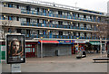
Living in EC1V 9JS grants access to a range of retail and transport amenities within walking distance. Nearby shops include Co-op Old, M&S Old Street, and Aldi Old, offering everyday essentials. The area’s proximity to major rail, metro, and ferry stations ensures easy access to London’s business districts, cultural sites, and beyond. For example, Old Street Station connects to the City of London, while Farringdon links to King’s Cross and St. Pancras. Ferry piers provide scenic routes along the Thames, and bus routes serve destinations like Victoria and central London. The combination of retail, transport, and connectivity creates a convenient lifestyle, ideal for those prioritising accessibility over expansive living spaces. The area’s compact nature means residents can reach amenities swiftly, though the lack of green spaces may require trips to nearby parks or parks further afield.
Amenities
Schools
The schools near EC1V 9JS include Moorfields Primary School, Prior Weston Primary School and Children’s Centre, and Central Foundation Boys’ School. All are primary schools, with Central Foundation Boys’ School holding an outstanding Ofsted rating. Prior Weston has a good rating, while Moorfields is not rated in the data. The presence of three primary schools provides multiple options for families, though the absence of secondary schools means parents may need to look beyond the immediate area for secondary education. The mix of school types suggests a focus on early education, with one institution performing exceptionally well. For families prioritising primary schooling, this area offers a range of choices, but secondary education planning would require additional research.
| Rank | School | Type | Entry gender | Ages |
|---|---|---|---|---|
| 1 | Moorfields Primary School | primary | N/A | N/A |
| 2 | Prior Weston Primary School and Children's Centre | primary | N/A | N/A |
| 3 | Central Foundation Boys' School | primary | N/A | N/A |
Explore more schools in this area
Go to Schools tabDemographics
The population of EC1V 9JS is 2,356, with a median age of 47. The majority of residents fall within the 30–64 age range, indicating a mature, established community. Home ownership is relatively low at 22%, suggesting that most residents rent their properties. The accommodation type is predominantly flats, reflecting the area’s density and limited availability of larger homes. The predominant ethnic group is White, though the data does not specify further diversity metrics. This demographic profile implies a stable, possibly professional workforce, with fewer families compared to areas with higher home ownership rates. The low home ownership percentage may also indicate a transient population, with individuals prioritising location over long-term residency. The absence of specific deprivation data means the quality of life cannot be fully assessed, but the age profile and housing stock suggest a community focused on convenience and proximity to urban amenities.
Household Size
Accommodation Type
Tenure
Ethnic Group
Religion
Household Composition
Age
Household Deprivation
NS-SEC
Explore more demographic insights in this area
Go to Demographics tabPlanning
Planning Constraints
- Flood RiskLocked
- Ramsar Wetland SitesLocked
- Area of Outstanding Natural BeautyLocked
- Protected Nature ReserveLocked
- Protected WoodlandLocked
- Crime RiskLocked