Area Overview for EC1A 9HQ
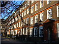
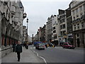
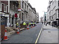
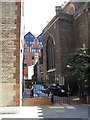
Photos of EC1A 9HQ


Area Information
EC1A 9HQ is a compact postcode area in central London, spanning just 2,912 square metres and home to 1,392 residents. Its high population density—over 478,000 people per square kilometre—reflects its role as a tightly knit urban enclave. This is not a sprawling suburb but a focused cluster of properties, likely centred around specific buildings or developments. Living here means navigating a densely populated environment where proximity to amenities is both a convenience and a constraint. The area’s small size suggests a strong local identity, though its exact boundaries and distinctiveness are shaped by its immediate surroundings. With no major natural or protected sites nearby, its character is defined by urban infrastructure, transport hubs, and the mix of retail and public services within reach. For those seeking a compact, well-connected urban lifestyle, EC1A 9HQ offers proximity to London’s core, but its limited space means every choice—where to live, work, or socialise—is tightly woven into a small geographic footprint.
- Area Type
- Postcode
- Area Size
- 2912 m²
- Population
- Not available
- Population Density
- Not available
EC1A 9HQ’s property market is characterised by a low home ownership rate (28%) and a focus on flats, suggesting it is not a traditional owner-occupied area but rather a rental market. The small area size and high population density imply limited housing stock, with properties likely concentrated in multi-unit developments. This makes the area more attractive to renters seeking proximity to central London’s transport and amenities, rather than buyers looking for long-term investment. The predominance of flats may also indicate a lack of larger family homes, which could limit appeal for those requiring more space. For buyers, the small size of the area means competition for properties is likely fierce, with limited scope for expansion or redevelopment. The market here is niche, catering to those prioritising location over property type, but the low ownership rate suggests it may not be a stable long-term option for homeowners.
House Prices in EC1A 9HQ
Showing 3 properties
| Address | Type | Beds | Baths | Last Sale Price | Last Sale Date | |
|---|---|---|---|---|---|---|
| Master's Flat, Haberdashers Hall, 18 West Smithfield, London, EC1A 9HQ | Flat | - | - | - | - | |
| 27 Hosier Lane, London, EC1A 9HQ | Flat | 1 | - | - | - | |
| Beadle's Flat, Haberdashers Hall, 18 West Smithfield, London, EC1A 9HQ | Flat | - | - | - | - |
Energy Efficiency in EC1A 9HQ
Living in EC1A 9HQ grants access to a range of retail and transport hubs within close proximity. Nearby supermarkets include Tesco Smithfield, Tesco Holborn, and Sainsburys Farringdon, ensuring daily shopping needs are met. The area’s transport infrastructure is its defining feature, with Farringdon Station, St. Paul’s Station, and City Thameslink providing seamless connections to London’s rail and metro networks. Ferry piers at Blackfriars and Bankside offer alternative routes, while bus services and coach stations like Victoria Coach Station enhance regional accessibility. The density of amenities suggests a lifestyle focused on convenience, though the lack of green spaces or leisure facilities within the area itself means residents may need to venture further for parks or recreational activities. The mix of retail, transport, and public services creates a functional urban environment, ideal for those prioritising connectivity over expansive living spaces.
Amenities
Schools
The only school explicitly listed near EC1A 9HQ is Charterhouse Square School, an independent institution with an outstanding Ofsted rating. This suggests a high standard of education, though the absence of state schools or additional educational institutions means the area’s school options are limited to one primary or secondary provider. For families relying on state education, the lack of other schools nearby could be a concern, requiring reliance on commuting to other parts of London. The presence of an independent school, however, may attract households prioritising private education. The single school listed indicates that the area’s educational infrastructure is not expansive, which could influence decisions for families with multiple children or those seeking a range of school types.
| Rank | School | Type | Entry gender | Ages |
|---|
Explore more schools in this area
Go to Schools tabDemographics
The population of EC1A 9HQ is predominantly adults aged 30–64, with a median age of 47. This suggests a mature, established community, likely with long-term residents rather than a transient population. Home ownership is low at 28%, indicating that most residents are renters, possibly in flats given the accommodation type listed. The area is ethnically homogenous, with the White population forming the majority. This demographic profile points to a community that prioritises stability and proximity to urban amenities over property ownership. The absence of specific data on deprivation levels means the quality of life here is inferred from the available infrastructure and services. With a high proportion of adults in their prime working years, the area may cater to professionals or those in established careers, though the lack of family-oriented data—such as school numbers beyond one—suggests it may not be a primary choice for growing families.
Household Size
Accommodation Type
Tenure
Ethnic Group
Religion
Household Composition
Age
Household Deprivation
NS-SEC
Explore more demographic insights in this area
Go to Demographics tabPlanning
Planning Constraints
- Flood RiskPremium
- Ramsar Wetland SitesPremium
- Area of Outstanding Natural BeautyPremium
- Protected Nature ReservePremium
- Protected WoodlandPremium